Cinq-Mars-la-Pile geodata
Cinq-Mars-la-Pile (Centre) is a populated place; located in France in Europe/Paris (GMT+2) time zone. With population of 2,877 people, there are 3393 cities with bigger population in this country. Compared to other cities in France, 50.8% of cities are located further ↑North; 73.8% of cities are located further →East and 82.6% of cities have higher elevation than Cinq-Mars-la-Pile. Note1
Administrative division(s):
- Level 1: Centre
- Level 2: Département d'Indre-et-Loire
- Level 3: Arrondissement de Chinon
- Level 4: Cinq-Mars-la-Pile


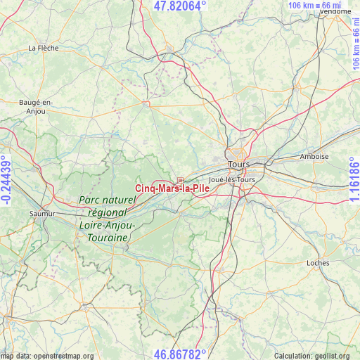
Cinq-Mars-la-Pile GPS coordinates[2]
47° 20' 46.968" North, 0° 27' 31.428" East
| Map corner | latitude | longitude |
|---|---|---|
| Upper-left | 47.82064°, | -0.24439° |
| Center: | 47.34638°, | 0.45873° |
| Lower-right: | 46.86782°, | 1.16186° |
| Map W x H: | 105.9×105.9 km | = 65.8×65.8mi |
| max Lat: | 51.07786° ⇑50.8% North |
| Cinq-Mars-la-Pile: | 47.34638° |
| min Lat: | ⇓49.2% South 41.3874° |
| min Long | Cinq-Mars-la-Pi | max Long |
| -5.08615° | 0.45873° | 9.52242° |
| W 26.2%⇐ | ⇒73.8% E |
Elevation
Elevation of Cinq-Mars-la-Pile is 48 m = 157 ft, and this is 145.7 m = 478 ft below average elevation for this country.
| Max E: |
2333 m = 7654 ft | 82.6% |
| Avg. | 193.7 m = 635 ft | |
| Cinq-Mars-la-Pile | 48 m = 157 ft | |
Min E: |
-1 m = -3 ft | 17.4% |
See also: France elevation on elevation.city.
Geographical zone
Cinq-Mars-la-Pile is located in North temperate zone (between Tropic of Cancer and the Arctic Circle). Distance of this North polar circle is 2136.8 km =1327.7 mi to North.| Distance of | km | miles | from Cinq-Mars-la-Pile |
|---|---|---|---|
| North Pole | 4742.6 | 2946.9 | to North |
| Arctic Circle | 2136.8 | 1327.7 | to North |
| Tropic Cancer | 2658.5 | 1651.9 | to South |
| Equator | 5264.4 | 3271.1 | to South |


Nearby cities:
15 places around Cinq-Mars-la-Pile: (largest is in red/bold)
• Azay-le-Rideau
9.2 km =5.7 mi,  174°
174°
• Berthenay
5.4 km =3.4 mi,  69°
69°
• Bréhémont
9.4 km =5.8 mi,  232°
232°
• Cléré-les-Pins
10.2 km =6.3 mi,  329°
329°
• Druye
7.3 km =4.5 mi,  124°
124°
• La Chapelle-aux-Naux
4 km =2.5 mi,  216°
216°
• Langeais
4.9 km =3 mi,  242°
242°
• Lignières-de-Touraine
6.3 km =3.9 mi,  210°
210°
• Luynes
8.4 km =5.2 mi,  59°
59°
• Mazières-de-Touraine
4.8 km =3 mi, 328°
• Saint-Michel-sur-Loire
9.3 km =5.8 mi, 242°
• Saint-Étienne-de-Chigny
7 km =4.3 mi,  53°
53°
• Savonnières
6.8 km =4.2 mi,  88°
88°
• Vallères
4 km =2.5 mi,  163°
163°
• Villandry
4 km =2.5 mi,  100°
100°
Sources, notices
• [Note1] Compared only with cities in France existing in our database
• [Src1] Map data: © OpenStreetMap contributors (CC-BY-SA)
• [Src2] Other city data from geonames.org with taken over terms of usage.
• [Src3] Geographical zone / Annual Mean Temperature by Robert A. Rohde @ Wikipedia
