Saint-Cyprien-sur-Dourdou geodata
Saint-Cyprien-sur-Dourdou (Occitanie) is a populated place; located in France in Europe/Paris (GMT+2) time zone. With population of 811 people, there are 10468 cities with bigger population in this country. Compared to other cities in France, 83.2% of cities are located further ↑North; 50.9% of cities are located further →East and 79.3% of cities have lower elevation than Saint-Cyprien-sur-Dourdou. Note1
Administrative division(s):
- Level 1: Occitanie
- Level 2: Département de l'Aveyron
- Level 3: Arrondissement de Rodez
- Level 4: Conques-en-Rouergue
Current local time in Saint-Cyprien-sur-Dourdou:
11:28 AM, SaturdayDifference from your time zone: hours


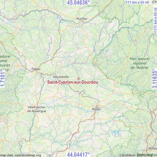
Saint-Cyprien-sur-Dourdou GPS coordinates[2]
44° 32' 50.712" North, 2° 24' 47.592" East
| Map corner | latitude | longitude |
|---|---|---|
| Upper-left | 45.04636°, | 1.7101° |
| Center: | 44.54742°, | 2.41322° |
| Lower-right: | 44.04417°, | 3.11635° |
| Map W x H: | 111.4×111.4 km | = 69.2×69.2mi |
| max Lat: | 51.07786° ⇑83.2% North |
| Saint-Cyprien-sur-Dourdou: | 44.54742° |
| min Lat: | ⇓16.8% South 41.3874° |
| min Long | Saint-Cyprien-s | max Long |
| -5.08615° | 2.41322° | 9.52242° |
| W 49.1%⇐ | ⇒50.9% E |
Elevation
Elevation of Saint-Cyprien-sur-Dourdou is 283 m = 928 ft, and this is 89.3 m = 293 ft above average elevation for this country.
| Max E: |
2333 m = 7654 ft | 20.7% |
| Saint-Cyprien-sur-Dourdou | 283 m 928 ft | |
| Avg. | 193.7 m = 635 ft | |
Min E: |
-1 m = -3 ft | 79.3% |
See also: France elevation on elevation.city.
Geographical zone
Saint-Cyprien-sur-Dourdou is located in North temperate zone (between Tropic of Cancer and the Arctic Circle). Distance of this Northern Tropic circle is 2347.3 km =1458.5 mi to South.| Distance of | km | miles | from Saint-Cyprien-sur-Dourdou |
|---|---|---|---|
| North Pole | 5053.9 | 3140.3 | to North |
| Arctic Circle | 2448 | 1521.1 | to North |
| Tropic Cancer | 2347.3 | 1458.5 | to South |
| Equator | 4953.2 | 3077.8 | to South |


Nearby cities:
15 places around Saint-Cyprien-sur-Dourdou: (largest is in red/bold)
• Aubin
13.6 km =8.5 mi,  260°
260°
• Auzits
8.1 km =5 mi,  235°
235°
• Balsac
16.2 km =10.1 mi,  170°
170°
• Cassaniouze
16.1 km =10 mi,  351°
351°
• Cransac
10.6 km =6.6 mi, 255°
• Decazeville
12.9 km =8 mi,  276°
276°
• Firmi
8.4 km =5.2 mi,  265°
265°
• Flagnac
14.6 km =9.1 mi,  296°
296°
• Livinhac-le-Haut
15.3 km =9.5 mi,  289°
289°
• Marcillac-Vallon
9.1 km =5.7 mi,  153°
153°
• Saint-Christophe-Vallon
8.5 km =5.3 mi,  180°
180°
• Salles-la-Source
14.8 km =9.2 mi, 147°
• Sénergues
8.6 km =5.3 mi,  41°
41°
• Valady
10.2 km =6.3 mi, 173°
• Viviez
15.6 km =9.7 mi, 273°
Sources, notices
• [Note1] Compared only with cities in France existing in our database
• [Src1] Map data: © OpenStreetMap contributors (CC-BY-SA)
• [Src2] Other city data from geonames.org with taken over terms of usage.
• [Src3] Geographical zone / Annual Mean Temperature by Robert A. Rohde @ Wikipedia
