Marcillac-Vallon geodata
Marcillac-Vallon (Occitanie) is a populated place; located in France in Europe/Paris (GMT+2) time zone. With population of 1,635 people, there are 5713 cities with bigger population in this country. Compared to other cities in France, 83.8% of cities are located further ↑North; 50% of cities are located further ←West and 79.3% of cities have lower elevation than Marcillac-Vallon. Note1
Administrative division(s):
- Level 1: Occitanie
- Level 2: Département de l'Aveyron
- Level 3: Arrondissement de Rodez
- Level 4: Marcillac-Vallon


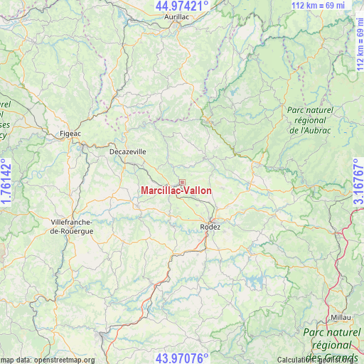
Marcillac-Vallon GPS coordinates[2]
44° 28' 28.704" North, 2° 27' 52.344" East
| Map corner | latitude | longitude |
|---|---|---|
| Upper-left | 44.97421°, | 1.76142° |
| Center: | 44.47464°, | 2.46454° |
| Lower-right: | 43.97076°, | 3.16767° |
| Map W x H: | 111.6×111.6 km | = 69.3×69.3mi |
| max Lat: | 51.07786° ⇑83.8% North |
| Marcillac-Vallon: | 44.47464° |
| min Lat: | ⇓16.2% South 41.3874° |
| min Long | Marcillac-Vallo | max Long |
| -5.08615° | 2.46454° | 9.52242° |
| W 50%⇐ | ⇒50% E |
Elevation
Elevation of Marcillac-Vallon is 283 m = 928 ft, and this is 89.3 m = 293 ft above average elevation for this country.
| Max E: |
2333 m = 7654 ft | 20.7% |
| Marcillac-Vallon | 283 m 928 ft | |
| Avg. | 193.7 m = 635 ft | |
Min E: |
-1 m = -3 ft | 79.3% |
See also: France elevation on elevation.city.
Geographical zone
Marcillac-Vallon is located in North temperate zone (between Tropic of Cancer and the Arctic Circle). Distance of this Northern Tropic circle is 2339.2 km =1453.5 mi to South.| Distance of | km | miles | from Marcillac-Vallon |
|---|---|---|---|
| North Pole | 5061.9 | 3145.3 | to North |
| Arctic Circle | 2456.1 | 1526.1 | to North |
| Tropic Cancer | 2339.2 | 1453.5 | to South |
| Equator | 4945.1 | 3072.7 | to South |


Nearby cities:
15 places around Marcillac-Vallon: (largest is in red/bold)
• Auzits
11.3 km =7 mi,  287°
287°
• Balsac
8.1 km =5 mi,  191°
191°
• Cransac
15.4 km =9.6 mi, 290°
• Druelle
13.1 km =8.1 mi,  165°
165°
• Firmi
14.5 km =9 mi,  300°
300°
• Moyrazès
14.9 km =9.3 mi, 187°
• Olemps
15.8 km =9.8 mi,  154°
154°
• Rignac
15.7 km =9.8 mi,  242°
242°
• Rodelle
12.8 km =8 mi,  81°
81°
• Saint-Christophe-Vallon
4.2 km =2.6 mi,  264°
264°
• Saint-Cyprien-sur-Dourdou
9.1 km =5.7 mi,  333°
333°
• Salles-la-Source
5.8 km =3.6 mi,  138°
138°
• Sébazac-Concourès
13.5 km =8.4 mi,  125°
125°
• Sénergues
14.6 km =9.1 mi,  6°
6°
• Valady
3.6 km =2.2 mi, 235°
Sources, notices
• [Note1] Compared only with cities in France existing in our database
• [Src1] Map data: © OpenStreetMap contributors (CC-BY-SA)
• [Src2] Other city data from geonames.org with taken over terms of usage.
• [Src3] Geographical zone / Annual Mean Temperature by Robert A. Rohde @ Wikipedia
