Saint-Clément-Rancoudray geodata
Saint-Clément-Rancoudray (Normandy) is a populated place; located in France in Europe/Paris (GMT+2) time zone. With population of 597 people, there are 13370 cities with bigger population in this country. Compared to other cities in France, 72.4% of cities are located further ↓South; 87.2% of cities are located further →East and 80.8% of cities have lower elevation than Saint-Clément-Rancoudray. Note1
Administrative division(s):
- Level 1: Normandy
- Level 2: Manche
- Level 3: Avranches
- Level 4: Saint-Clément-Rancoudray
Current local time in Saint-Clément-Rancoudray:
06:41 PM, SaturdayDifference from your time zone: hours


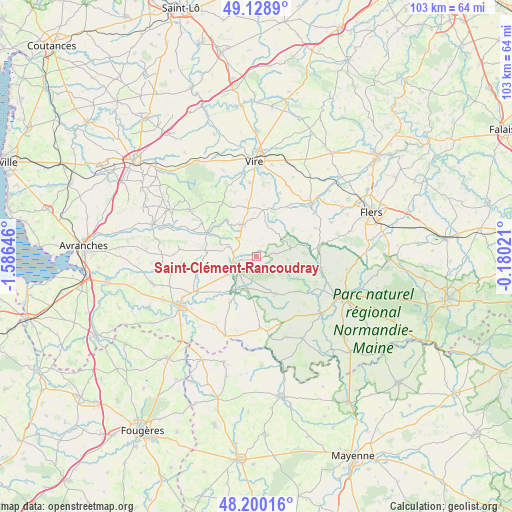
Saint-Clément-Rancoudray GPS coordinates[2]
48° 40' 0.012" North, 0° 52' 59.988" West
| Map corner | latitude | longitude |
|---|---|---|
| Upper-left | 49.1289°, | -1.58646° |
| Center: | 48.66667°, | -0.88333° |
| Lower-right: | 48.20016°, | -0.18021° |
| Map W x H: | 103.3×103.3 km | = 64.2×64.2mi |
| max Lat: | 51.07786° ⇑27.6% North |
| Saint-Clément-Rancoudray: | 48.66667° |
| min Lat: | ⇓72.4% South 41.3874° |
| min Long | Saint-Clément- | max Long |
| -5.08615° | -0.88333° | 9.52242° |
| W 12.8%⇐ | ⇒87.2% E |
Elevation
Elevation of Saint-Clément-Rancoudray is 299 m = 981 ft, and this is 105.3 m = 345 ft above average elevation for this country.
| Max E: |
2333 m = 7654 ft | 19.2% |
| Saint-Clément-Rancoudray | 299 m 981 ft | |
| Avg. | 193.7 m = 635 ft | |
Min E: |
-1 m = -3 ft | 80.8% |
See also: France elevation on elevation.city.
Geographical zone
Saint-Clément-Rancoudray is located in North temperate zone (between Tropic of Cancer and the Arctic Circle). Distance of this North polar circle is 1989.9 km =1236.5 mi to North.| Distance of | km | miles | from Saint-Clément-Rancoudray |
|---|---|---|---|
| North Pole | 4595.8 | 2855.7 | to North |
| Arctic Circle | 1989.9 | 1236.5 | to North |
| Tropic Cancer | 2805.3 | 1743.1 | to South |
| Equator | 5411.2 | 3362.4 | to South |


Nearby cities:
15 places around Saint-Clément-Rancoudray: (largest is in red/bold)
• Barenton
8.3 km =5.2 mi,  153°
153°
• Ger
7.1 km =4.4 mi,  76°
76°
• Juvigny-le-Tertre
10.3 km =6.4 mi,  276°
276°
• Le Neufbourg
4.9 km =3 mi,  255°
255°
• Le Teilleul
14.4 km =8.9 mi,  176°
176°
• Mortain
4.7 km =2.9 mi,  243°
243°
• Notre-Dame-du-Touchet
10.8 km =6.7 mi,  210°
210°
• Romagny
6.8 km =4.2 mi, 243°
• Saint-Cornier-des-Landes
13.3 km =8.3 mi,  64°
64°
• Saint-Georges-de-Rouelley
11 km =6.8 mi,  129°
129°
• Saint-Pois
16.3 km =10.1 mi,  304°
304°
• Sourdeval
6.9 km =4.3 mi,  335°
335°
• Tinchebray
15.5 km =9.6 mi,  45°
45°
• Truttemer-le-Grand
13.6 km =8.5 mi,  20°
20°
• Vengeons
10 km =6.2 mi,  345°
345°
Sources, notices
• [Note1] Compared only with cities in France existing in our database
• [Src1] Map data: © OpenStreetMap contributors (CC-BY-SA)
• [Src2] Other city data from geonames.org with taken over terms of usage.
• [Src3] Geographical zone / Annual Mean Temperature by Robert A. Rohde @ Wikipedia
