Barenton geodata
Barenton (Normandy) is a populated place; located in France in Europe/Paris (GMT+2) time zone. With population of 1,426 people, there are 6503 cities with bigger population in this country. Compared to other cities in France, 70.9% of cities are located further ↓South; 86.7% of cities are located further →East and 51.9% of cities have lower elevation than Barenton. Note1


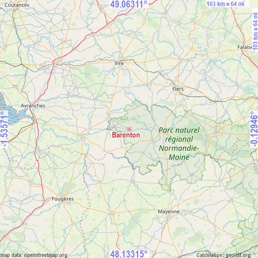
Barenton GPS coordinates[2]
48° 36' 0.972" North, 0° 49' 57.288" West
| Map corner | latitude | longitude |
|---|---|---|
| Upper-left | 49.06311°, | -1.53571° |
| Center: | 48.60027°, | -0.83258° |
| Lower-right: | 48.13315°, | -0.12946° |
| Map W x H: | 103.4×103.4 km | = 64.2×64.2mi |
| max Lat: | 51.07786° ⇑29.1% North |
| Barenton: | 48.60027° |
| min Lat: | ⇓70.9% South 41.3874° |
| min Long | Barenton | max Long |
| -5.08615° | -0.83258° | 9.52242° |
| W 13.3%⇐ | ⇒86.7% E |
Elevation
Elevation of Barenton is 139 m = 456 ft, and this is 54.7 m = 179 ft below average elevation for this country.
| Max E: |
2333 m = 7654 ft | 48.1% |
| Avg. | 193.7 m = 635 ft | |
| Barenton | 139 m = 456 ft | |
Min E: |
-1 m = -3 ft | 51.9% |
See also: France elevation on elevation.city.
Geographical zone
Barenton is located in North temperate zone (between Tropic of Cancer and the Arctic Circle). Distance of this North polar circle is 1997.3 km =1241.1 mi to North.| Distance of | km | miles | from Barenton |
|---|---|---|---|
| North Pole | 4603.2 | 2860.3 | to North |
| Arctic Circle | 1997.3 | 1241.1 | to North |
| Tropic Cancer | 2797.9 | 1738.5 | to South |
| Equator | 5403.8 | 3357.8 | to South |


Nearby cities:
15 places around Barenton: (largest is in red/bold)
• Buais
13.3 km =8.3 mi,  229°
229°
• Domfront
13.8 km =8.6 mi,  93°
93°
• Désertines
14.8 km =9.2 mi,  189°
189°
• Ger
9.6 km =6 mi,  19°
19°
• La Haute-Chapelle
12 km =7.5 mi, 87°
• Le Neufbourg
10.5 km =6.5 mi,  305°
305°
• Le Teilleul
7.6 km =4.7 mi,  203°
203°
• Mantilly
9.2 km =5.7 mi,  165°
165°
• Mortain
9.5 km =5.9 mi,  303°
303°
• Notre-Dame-du-Touchet
9.3 km =5.8 mi,  257°
257°
• Passais
10.5 km =6.5 mi,  152°
152°
• Romagny
10.7 km =6.6 mi,  293°
293°
• Saint-Clément-Rancoudray
8.3 km =5.2 mi,  333°
333°
• Saint-Georges-de-Rouelley
4.7 km =2.9 mi, 85°
• Sourdeval
15.2 km =9.4 mi, 334°
Sources, notices
• [Note1] Compared only with cities in France existing in our database
• [Src1] Map data: © OpenStreetMap contributors (CC-BY-SA)
• [Src2] Other city data from geonames.org with taken over terms of usage.
• [Src3] Geographical zone / Annual Mean Temperature by Robert A. Rohde @ Wikipedia
