Romagny geodata
Romagny (Normandy) is a populated place; located in France in Europe/Paris (GMT+2) time zone. With population of 1,076 people, there are 8284 cities with bigger population in this country. Compared to other cities in France, 71.8% of cities are located further ↓South; 87.9% of cities are located further →East and 55.9% of cities have lower elevation than Romagny. Note1
Administrative division(s):
- Level 1: Normandy
- Level 2: Manche
- Level 3: Avranches
- Level 4: Romagny Fontenay


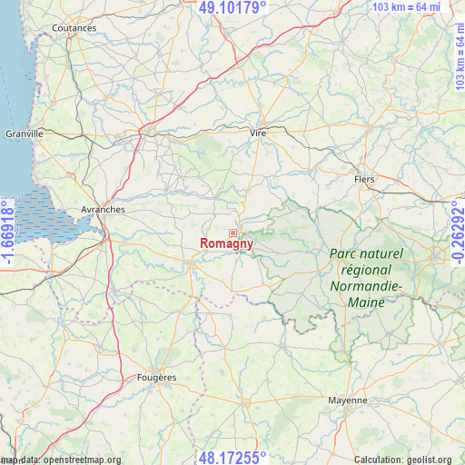
Romagny GPS coordinates[2]
48° 38' 21.516" North, 0° 57' 57.78" West
| Map corner | latitude | longitude |
|---|---|---|
| Upper-left | 49.10179°, | -1.66918° |
| Center: | 48.63931°, | -0.96605° |
| Lower-right: | 48.17255°, | -0.26292° |
| Map W x H: | 103.3×103.3 km | = 64.2×64.2mi |
| max Lat: | 51.07786° ⇑28.2% North |
| Romagny: | 48.63931° |
| min Lat: | ⇓71.8% South 41.3874° |
| min Long | Romagny | max Long |
| -5.08615° | -0.96605° | 9.52242° |
| W 12.1%⇐ | ⇒87.9% E |
Elevation
Elevation of Romagny is 153 m = 502 ft, and this is 40.7 m = 134 ft below average elevation for this country.
| Max E: |
2333 m = 7654 ft | 44.1% |
| Avg. | 193.7 m = 635 ft | |
| Romagny | 153 m = 502 ft | |
Min E: |
-1 m = -3 ft | 55.9% |
See also: France elevation on elevation.city.
Geographical zone
Romagny is located in North temperate zone (between Tropic of Cancer and the Arctic Circle). Distance of this North polar circle is 1993 km =1238.4 mi to North.| Distance of | km | miles | from Romagny |
|---|---|---|---|
| North Pole | 4598.9 | 2857.6 | to North |
| Arctic Circle | 1993 | 1238.4 | to North |
| Tropic Cancer | 2802.3 | 1741.3 | to South |
| Equator | 5408.2 | 3360.5 | to South |


Nearby cities:
15 places around Romagny: (largest is in red/bold)
• Barenton
10.7 km =6.6 mi,  113°
113°
• Buais
13 km =8.1 mi,  181°
181°
• Ger
13.8 km =8.6 mi,  70°
70°
• Juvigny-le-Tertre
5.9 km =3.7 mi,  315°
315°
• Le Neufbourg
2.2 km =1.4 mi,  35°
35°
• Le Teilleul
13.2 km =8.2 mi,  148°
148°
• Mortain
2.1 km =1.3 mi,  63°
63°
• Notre-Dame-du-Touchet
6.3 km =3.9 mi,  173°
173°
• Parigny
9.7 km =6 mi,  239°
239°
• Reffuveille
11.3 km =7 mi,  286°
286°
• Saint-Clément-Rancoudray
6.8 km =4.2 mi, 63°
• Saint-Hilaire-du-Harcouët
11.4 km =7.1 mi,  232°
232°
• Sourdeval
9.9 km =6.2 mi,  19°
19°
• Vengeons
13.3 km =8.3 mi, 15°
• Virey
13.7 km =8.5 mi, 243°
Sources, notices
• [Note1] Compared only with cities in France existing in our database
• [Src1] Map data: © OpenStreetMap contributors (CC-BY-SA)
• [Src2] Other city data from geonames.org with taken over terms of usage.
• [Src3] Geographical zone / Annual Mean Temperature by Robert A. Rohde @ Wikipedia
