Mortain geodata
Mortain (Normandy) is a populated place; located in France in Europe/Paris (GMT+2) time zone. With population of 2,470 people, there are 3931 cities with bigger population in this country. Compared to other cities in France, 72% of cities are located further ↓South; 87.7% of cities are located further →East and 73% of cities have lower elevation than Mortain. Note1
Administrative division(s):
- Level 1: Normandy
- Level 2: Manche
- Level 3: Avranches
- Level 4: Mortain-Bocage


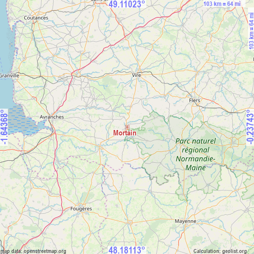
Mortain GPS coordinates[2]
48° 38' 52.152" North, 0° 56' 25.98" West
| Map corner | latitude | longitude |
|---|---|---|
| Upper-left | 49.11023°, | -1.64368° |
| Center: | 48.64782°, | -0.94055° |
| Lower-right: | 48.18113°, | -0.23743° |
| Map W x H: | 103.3×103.3 km | = 64.2×64.2mi |
| max Lat: | 51.07786° ⇑28% North |
| Mortain: | 48.64782° |
| min Lat: | ⇓72% South 41.3874° |
| min Long | Mortain | max Long |
| -5.08615° | -0.94055° | 9.52242° |
| W 12.3%⇐ | ⇒87.7% E |
Elevation
Elevation of Mortain is 236 m = 774 ft, and this is 42.3 m = 139 ft above average elevation for this country.
| Max E: |
2333 m = 7654 ft | 27% |
| Mortain | 236 m 774 ft | |
| Avg. | 193.7 m = 635 ft | |
Min E: |
-1 m = -3 ft | 73% |
See also: France elevation on elevation.city.
Geographical zone
Mortain is located in North temperate zone (between Tropic of Cancer and the Arctic Circle). Distance of this North polar circle is 1992 km =1237.8 mi to North.| Distance of | km | miles | from Mortain |
|---|---|---|---|
| North Pole | 4597.9 | 2857 | to North |
| Arctic Circle | 1992 | 1237.8 | to North |
| Tropic Cancer | 2803.2 | 1741.8 | to South |
| Equator | 5409.1 | 3361.1 | to South |


Nearby cities:
15 places around Mortain: (largest is in red/bold)
• Barenton
9.5 km =5.9 mi,  123°
123°
• Buais
14.1 km =8.8 mi,  188°
188°
• Ger
11.8 km =7.3 mi,  71°
71°
• Juvigny-le-Tertre
6.8 km =4.2 mi,  298°
298°
• Le Neufbourg
1 km =0.6 mi,  326°
326°
• Le Teilleul
13.2 km =8.2 mi,  157°
157°
• Notre-Dame-du-Touchet
7.3 km =4.5 mi, 189°
• Parigny
11.8 km =7.3 mi,  239°
239°
• Reffuveille
12.9 km =8 mi,  280°
280°
• Romagny
2.1 km =1.3 mi, 243°
• Saint-Clément-Rancoudray
4.7 km =2.9 mi,  63°
63°
• Saint-Georges-de-Rouelley
13.6 km =8.5 mi,  111°
111°
• Saint-Hilaire-du-Harcouët
13.5 km =8.4 mi,  234°
234°
• Sourdeval
8.5 km =5.3 mi,  9°
9°
• Vengeons
11.9 km =7.4 mi, 8°
Sources, notices
• [Note1] Compared only with cities in France existing in our database
• [Src1] Map data: © OpenStreetMap contributors (CC-BY-SA)
• [Src2] Other city data from geonames.org with taken over terms of usage.
• [Src3] Geographical zone / Annual Mean Temperature by Robert A. Rohde @ Wikipedia
