Saint-Clar geodata
Saint-Clar (Occitanie) is a populated place; located in France in Europe/Paris (GMT+2) time zone. With population of 990 people, there are 8905 cities with bigger population in this country. Compared to other cities in France, 88.2% of cities are located further ↑North; 70.8% of cities are located further →East and 58.4% of cities have lower elevation than Saint-Clar. Note1
Administrative division(s):
- Level 1: Occitanie
- Level 2: Gers
- Level 3: Arrondissement de Condom
- Level 4: Saint-Clar


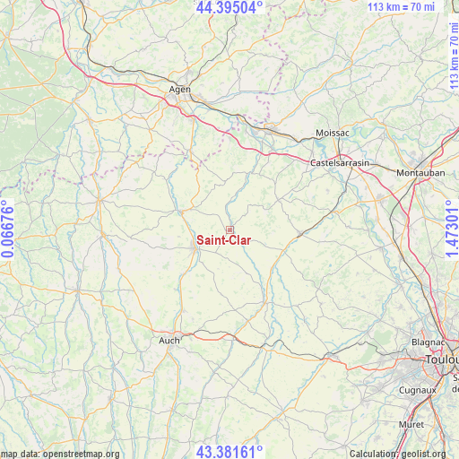
Saint-Clar GPS coordinates[2]
43° 53' 25.728" North, 0° 46' 11.568" East
| Map corner | latitude | longitude |
|---|---|---|
| Upper-left | 44.39504°, | 0.06676° |
| Center: | 43.89048°, | 0.76988° |
| Lower-right: | 43.38161°, | 1.47301° |
| Map W x H: | 112.7×112.7 km | = 70×70mi |
| max Lat: | 51.07786° ⇑88.2% North |
| Saint-Clar: | 43.89048° |
| min Lat: | ⇓11.8% South 41.3874° |
| min Long | Saint-Clar | max Long |
| -5.08615° | 0.76988° | 9.52242° |
| W 29.2%⇐ | ⇒70.8% E |
Elevation
Elevation of Saint-Clar is 163 m = 535 ft, and this is 30.7 m = 101 ft below average elevation for this country.
| Max E: |
2333 m = 7654 ft | 41.6% |
| Avg. | 193.7 m = 635 ft | |
| Saint-Clar | 163 m = 535 ft | |
Min E: |
-1 m = -3 ft | 58.4% |
See also: France elevation on elevation.city.
Geographical zone
Saint-Clar is located in North temperate zone (between Tropic of Cancer and the Arctic Circle). Distance of this Northern Tropic circle is 2274.2 km =1413.1 mi to South.| Distance of | km | miles | from Saint-Clar |
|---|---|---|---|
| North Pole | 5126.9 | 3185.7 | to North |
| Arctic Circle | 2521 | 1566.5 | to North |
| Tropic Cancer | 2274.2 | 1413.1 | to South |
| Equator | 4880.2 | 3032.4 | to South |


Nearby cities:
15 places around Saint-Clar: (largest is in red/bold)
• Astaffort
21.5 km =13.4 mi,  333°
333°
• Auvillar
22.4 km =13.9 mi,  28°
28°
• Beaumont-de-Lomagne
17.5 km =10.9 mi,  92°
92°
• Dunes
22 km =13.7 mi,  0°
0°
• Fleurance
9.8 km =6.1 mi,  241°
241°
• La Romieu
23.9 km =14.9 mi,  295°
295°
• Lavit
14.1 km =8.8 mi,  58°
58°
• Lectoure
12.9 km =8 mi,  292°
292°
• Marignac
12.5 km =7.8 mi,  114°
114°
• Mauvezin
19.8 km =12.3 mi,  153°
153°
• Miradoux
12.1 km =7.5 mi,  354°
354°
• Montestruc-sur-Gers
15.6 km =9.7 mi,  226°
226°
• Pauilhac
12.7 km =7.9 mi,  262°
262°
• Preignan
23 km =14.3 mi,  210°
210°
• Sérignac
20.4 km =12.7 mi,  79°
79°
Sources, notices
• [Note1] Compared only with cities in France existing in our database
• [Src1] Map data: © OpenStreetMap contributors (CC-BY-SA)
• [Src2] Other city data from geonames.org with taken over terms of usage.
• [Src3] Geographical zone / Annual Mean Temperature by Robert A. Rohde @ Wikipedia
