Montestruc-sur-Gers geodata
Montestruc-sur-Gers (Occitanie) is a populated place; located in France in Europe/Paris (GMT+2) time zone. With population of 629 people, there are 12831 cities with bigger population in this country. Compared to other cities in France, 89.2% of cities are located further ↑North; 72% of cities are located further →East and 54.4% of cities have higher elevation than Montestruc-sur-Gers. Note1
Administrative division(s):
- Level 1: Occitanie
- Level 2: Gers
- Level 3: Arrondissement de Condom
- Level 4: Montestruc-sur-Gers


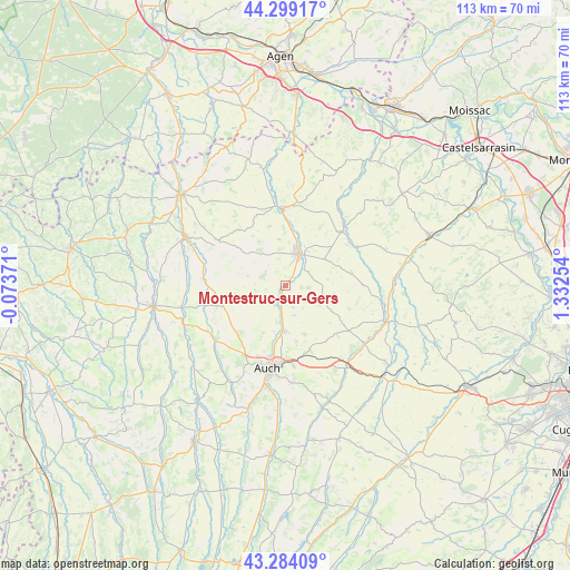
Montestruc-sur-Gers GPS coordinates[2]
43° 47' 37.644" North, 0° 37' 45.876" East
| Map corner | latitude | longitude |
|---|---|---|
| Upper-left | 44.29917°, | -0.07371° |
| Center: | 43.79379°, | 0.62941° |
| Lower-right: | 43.28409°, | 1.33254° |
| Map W x H: | 112.9×112.9 km | = 70.2×70.2mi |
| max Lat: | 51.07786° ⇑89.2% North |
| Montestruc-sur-Gers: | 43.79379° |
| min Lat: | ⇓10.8% South 41.3874° |
| min Long | Montestruc-sur- | max Long |
| -5.08615° | 0.62941° | 9.52242° |
| W 28%⇐ | ⇒72% E |
Elevation
Elevation of Montestruc-sur-Gers is 118 m = 387 ft, and this is 75.7 m = 248 ft below average elevation for this country.
| Max E: |
2333 m = 7654 ft | 54.4% |
| Avg. | 193.7 m = 635 ft | |
| Montestruc-sur-Gers | 118 m = 387 ft | |
Min E: |
-1 m = -3 ft | 45.6% |
See also: France elevation on elevation.city.
Geographical zone
Montestruc-sur-Gers is located in North temperate zone (between Tropic of Cancer and the Arctic Circle). Distance of this Northern Tropic circle is 2263.5 km =1406.5 mi to South.| Distance of | km | miles | from Montestruc-sur-Gers |
|---|---|---|---|
| North Pole | 5137.6 | 3192.4 | to North |
| Arctic Circle | 2531.8 | 1573.2 | to North |
| Tropic Cancer | 2263.5 | 1406.5 | to South |
| Equator | 4869.4 | 3025.7 | to South |


Nearby cities:
15 places around Montestruc-sur-Gers: (largest is in red/bold)
• Aubiet
20.6 km =12.8 mi,  142°
142°
• Auch
16.8 km =10.4 mi,  191°
191°
• Castéra-Verduzan
16 km =9.9 mi,  274°
274°
• Duran
14.9 km =9.3 mi,  200°
200°
• Fleurance
6.6 km =4.1 mi,  24°
24°
• Jegun
13.4 km =8.3 mi,  257°
257°
• Lectoure
15.7 km =9.8 mi,  357°
357°
• Ordan-Larroque
18.2 km =11.3 mi,  228°
228°
• Pauilhac
9.3 km =5.8 mi,  351°
351°
• Pavie
20.7 km =12.9 mi, 188°
• Pessan
19.3 km =12 mi,  175°
175°
• Preignan
9.1 km =5.7 mi, 181°
• Roquelaure
9.3 km =5.8 mi,  206°
206°
• Saint-Clar
15.6 km =9.7 mi,  46°
46°
• Saint-Puy
16.2 km =10.1 mi,  304°
304°
Sources, notices
• [Note1] Compared only with cities in France existing in our database
• [Src1] Map data: © OpenStreetMap contributors (CC-BY-SA)
• [Src2] Other city data from geonames.org with taken over terms of usage.
• [Src3] Geographical zone / Annual Mean Temperature by Robert A. Rohde @ Wikipedia
