Lectoure geodata
Lectoure (Occitanie) is a populated place; located in France in Europe/Paris (GMT+2) time zone. With population of 4,544 people, there are 2173 cities with bigger population in this country. Compared to other cities in France, 87.7% of cities are located further ↑North; 72.1% of cities are located further →East and 62.4% of cities have lower elevation than Lectoure. Note1
Administrative division(s):
- Level 1: Occitanie
- Level 2: Gers
- Level 3: Arrondissement de Condom
- Level 4: Lectoure


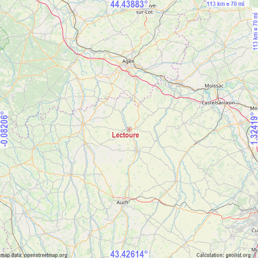
Lectoure GPS coordinates[2]
43° 56' 4.704" North, 0° 37' 15.852" East
| Map corner | latitude | longitude |
|---|---|---|
| Upper-left | 44.43883°, | -0.08206° |
| Center: | 43.93464°, | 0.62107° |
| Lower-right: | 43.42614°, | 1.32419° |
| Map W x H: | 112.6×112.6 km | = 70×70mi |
| max Lat: | 51.07786° ⇑87.7% North |
| Lectoure: | 43.93464° |
| min Lat: | ⇓12.3% South 41.3874° |
| min Long | Lectoure | max Long |
| -5.08615° | 0.62107° | 9.52242° |
| W 27.9%⇐ | ⇒72.1% E |
Elevation
Elevation of Lectoure is 181 m = 594 ft, and this is 12.7 m = 42 ft below average elevation for this country.
| Max E: |
2333 m = 7654 ft | 37.6% |
| Avg. | 193.7 m = 635 ft | |
| Lectoure | 181 m = 594 ft | |
Min E: |
-1 m = -3 ft | 62.4% |
See also: France elevation on elevation.city.
Geographical zone
Lectoure is located in North temperate zone (between Tropic of Cancer and the Arctic Circle). Distance of this Northern Tropic circle is 2279.2 km =1416.2 mi to South.| Distance of | km | miles | from Lectoure |
|---|---|---|---|
| North Pole | 5122 | 3182.7 | to North |
| Arctic Circle | 2516.1 | 1563.4 | to North |
| Tropic Cancer | 2279.2 | 1416.2 | to South |
| Equator | 4885.1 | 3035.5 | to South |


Nearby cities:
15 places around Lectoure: (largest is in red/bold)
• Astaffort
14.6 km =9.1 mi,  9°
9°
• Castéra-Verduzan
21 km =13 mi,  226°
226°
• Caussens
15.8 km =9.8 mi,  273°
273°
• Condom
20.1 km =12.5 mi,  277°
277°
• Dunes
20.9 km =13 mi,  35°
35°
• Fleurance
10.2 km =6.3 mi,  160°
160°
• Francescas
21.1 km =13.1 mi,  313°
313°
• La Romieu
11 km =6.8 mi,  298°
298°
• Laplume
21.1 km =13.1 mi,  339°
339°
• Miradoux
12.9 km =8 mi,  56°
56°
• Montestruc-sur-Gers
15.7 km =9.8 mi,  177°
177°
• Pauilhac
6.5 km =4 mi,  185°
185°
• Saint-Clar
12.9 km =8 mi,  112°
112°
• Saint-Puy
14.2 km =8.8 mi,  243°
243°
• Valence-sur-Baïse
20.1 km =12.5 mi,  253°
253°
Sources, notices
• [Note1] Compared only with cities in France existing in our database
• [Src1] Map data: © OpenStreetMap contributors (CC-BY-SA)
• [Src2] Other city data from geonames.org with taken over terms of usage.
• [Src3] Geographical zone / Annual Mean Temperature by Robert A. Rohde @ Wikipedia
