Saint-Chaptes geodata
Saint-Chaptes (Occitanie) is a populated place; located in France in Europe/Paris (GMT+2) time zone. With population of 1,282 people, there are 7120 cities with bigger population in this country. Compared to other cities in France, 87.3% of cities are located further ↑North; 70.4% of cities are located further ←West and 71.4% of cities have higher elevation than Saint-Chaptes. Note1
Administrative division(s):
- Level 1: Occitanie
- Level 2: Gard
- Level 3: Arrondissement de Nîmes
- Level 4: Saint-Chaptes


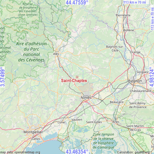
Saint-Chaptes GPS coordinates[2]
43° 58' 18.192" North, 4° 16' 41.232" East
| Map corner | latitude | longitude |
|---|---|---|
| Upper-left | 44.47559°, | 3.57499° |
| Center: | 43.97172°, | 4.27812° |
| Lower-right: | 43.46354°, | 4.98124° |
| Map W x H: | 112.5×112.5 km | = 69.9×69.9mi |
| max Lat: | 51.07786° ⇑87.3% North |
| Saint-Chaptes: | 43.97172° |
| min Lat: | ⇓12.7% South 41.3874° |
| min Long | Saint-Chaptes | max Long |
| -5.08615° | 4.27812° | 9.52242° |
| W 70.4%⇐ | ⇒29.6% E |
Elevation
Elevation of Saint-Chaptes is 75 m = 246 ft, and this is 118.7 m = 389 ft below average elevation for this country.
| Max E: |
2333 m = 7654 ft | 71.4% |
| Avg. | 193.7 m = 635 ft | |
| Saint-Chaptes | 75 m = 246 ft | |
Min E: |
-1 m = -3 ft | 28.6% |
See also: France elevation on elevation.city.
Geographical zone
Saint-Chaptes is located in North temperate zone (between Tropic of Cancer and the Arctic Circle). Distance of this Northern Tropic circle is 2283.3 km =1418.8 mi to South.| Distance of | km | miles | from Saint-Chaptes |
|---|---|---|---|
| North Pole | 5117.9 | 3180.1 | to North |
| Arctic Circle | 2512 | 1560.9 | to North |
| Tropic Cancer | 2283.3 | 1418.8 | to South |
| Equator | 4889.2 | 3038 | to South |


Nearby cities:
15 places around Saint-Chaptes: (largest is in red/bold)
• Arpaillargues-et-Aureillac
8.2 km =5.1 mi,  66°
66°
• Blauzac
7.4 km =4.6 mi,  98°
98°
• Boucoiran-et-Nozières
7.8 km =4.8 mi,  289°
289°
• Brignon
5.5 km =3.4 mi, 290°
• Cruviers-Lascours
6.9 km =4.3 mi,  299°
299°
• Dions
4.7 km =2.9 mi,  161°
161°
• Domessargues
8.9 km =5.5 mi,  272°
272°
• Gajan
10.1 km =6.3 mi,  211°
211°
• Garrigues-Sainte-Eulalie
3.3 km =2.1 mi, 67°
• La Calmette
5.5 km =3.4 mi,  189°
189°
• La Rouvière
5.7 km =3.5 mi,  218°
218°
• Moussac
4.3 km =2.7 mi,  284°
284°
• Saint-Geniès-de-Malgoirès
5.5 km =3.4 mi,  243°
243°
• Saint-Maurice-de-Cazevieille
7.3 km =4.5 mi,  330°
330°
• Sauzet
5.6 km =3.5 mi,  257°
257°
Sources, notices
• [Note1] Compared only with cities in France existing in our database
• [Src1] Map data: © OpenStreetMap contributors (CC-BY-SA)
• [Src2] Other city data from geonames.org with taken over terms of usage.
• [Src3] Geographical zone / Annual Mean Temperature by Robert A. Rohde @ Wikipedia
