Boucoiran-et-Nozières geodata
Boucoiran-et-Nozières (Occitanie) is a populated place; located in France in Europe/Paris (GMT+2) time zone. With population of 669 people, there are 12229 cities with bigger population in this country. Compared to other cities in France, 87.1% of cities are located further ↑North; 69.6% of cities are located further ←West and 66.6% of cities have higher elevation than Boucoiran-et-Nozières. Note1
Administrative division(s):
- Level 1: Occitanie
- Level 2: Gard
- Level 3: Arrondissement d’Alès
- Level 4: Boucoiran-et-Nozières


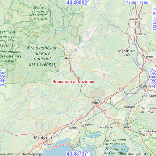
Boucoiran-et-Nozières GPS coordinates[2]
43° 59' 43.26" North, 4° 11' 8.592" East
| Map corner | latitude | longitude |
|---|---|---|
| Upper-left | 44.49902°, | 3.4826° |
| Center: | 43.99535°, | 4.18572° |
| Lower-right: | 43.48737°, | 4.88885° |
| Map W x H: | 112.5×112.5 km | = 69.9×69.9mi |
| max Lat: | 51.07786° ⇑87.1% North |
| Boucoiran-et-Nozières: | 43.99535° |
| min Lat: | ⇓12.9% South 41.3874° |
| min Long | Boucoiran-et-No | max Long |
| -5.08615° | 4.18572° | 9.52242° |
| W 69.6%⇐ | ⇒30.4% E |
Elevation
Elevation of Boucoiran-et-Nozières is 86 m = 282 ft, and this is 107.7 m = 353 ft below average elevation for this country.
| Max E: |
2333 m = 7654 ft | 66.6% |
| Avg. | 193.7 m = 635 ft | |
| Boucoiran-et-Nozières | 86 m = 282 ft | |
Min E: |
-1 m = -3 ft | 33.4% |
See also: France elevation on elevation.city.
Geographical zone
Boucoiran-et-Nozières is located in North temperate zone (between Tropic of Cancer and the Arctic Circle). Distance of this Northern Tropic circle is 2285.9 km =1420.4 mi to South.| Distance of | km | miles | from Boucoiran-et-Nozières |
|---|---|---|---|
| North Pole | 5115.2 | 3178.4 | to North |
| Arctic Circle | 2509.3 | 1559.2 | to North |
| Tropic Cancer | 2285.9 | 1420.4 | to South |
| Equator | 4891.8 | 3039.6 | to South |


Nearby cities:
15 places around Boucoiran-et-Nozières: (largest is in red/bold)
• Brignon
2.4 km =1.5 mi,  108°
108°
• Cardet
9.1 km =5.7 mi,  292°
292°
• Cruviers-Lascours
1.6 km =1 mi,  60°
60°
• Deaux
8.5 km =5.3 mi,  339°
339°
• Domessargues
2.7 km =1.7 mi,  214°
214°
• La Rouvière
8.1 km =5 mi,  151°
151°
• Lédignan
6.4 km =4 mi,  261°
261°
• Moussac
3.6 km =2.2 mi,  115°
115°
• Ners
4.1 km =2.5 mi,  331°
331°
• Ribaute-les-Tavernes
9.6 km =6 mi,  298°
298°
• Saint-Chaptes
7.8 km =4.8 mi, 109°
• Saint-Geniès-de-Malgoirès
5.6 km =3.5 mi, 153°
• Saint-Maurice-de-Cazevieille
5.4 km =3.4 mi,  45°
45°
• Sauzet
4.3 km =2.7 mi, 153°
• Vézénobres
7.3 km =4.5 mi, 328°
Sources, notices
• [Note1] Compared only with cities in France existing in our database
• [Src1] Map data: © OpenStreetMap contributors (CC-BY-SA)
• [Src2] Other city data from geonames.org with taken over terms of usage.
• [Src3] Geographical zone / Annual Mean Temperature by Robert A. Rohde @ Wikipedia
