Rouy geodata
Rouy (Bourgogne-Franche-Comté) is a populated place; located in France in Europe/Paris (GMT+2) time zone. With population of 601 people, there are 13304 cities with bigger population in this country. Compared to other cities in France, 55% of cities are located further ↑North; 64.6% of cities are located further ←West and 75.1% of cities have lower elevation than Rouy. Note1
Administrative division(s):
- Level 1: Bourgogne-Franche-Comté
- Level 2: Département de la Nièvre
- Level 3: Arrondissement de Nevers
- Level 4: Rouy


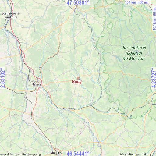
Rouy GPS coordinates[2]
47° 1' 33.096" North, 3° 32' 2.904" East
| Map corner | latitude | longitude |
|---|---|---|
| Upper-left | 47.50301°, | 2.83102° |
| Center: | 47.02586°, | 3.53414° |
| Lower-right: | 46.54441°, | 4.23727° |
| Map W x H: | 106.6×106.6 km | = 66.2×66.2mi |
| max Lat: | 51.07786° ⇑55% North |
| Rouy: | 47.02586° |
| min Lat: | ⇓45% South 41.3874° |
| min Long | Rouy | max Long |
| -5.08615° | 3.53414° | 9.52242° |
| W 64.6%⇐ | ⇒35.4% E |
Elevation
Elevation of Rouy is 250 m = 820 ft, and this is 56.3 m = 185 ft above average elevation for this country.
| Max E: |
2333 m = 7654 ft | 24.9% |
| Rouy | 250 m 820 ft | |
| Avg. | 193.7 m = 635 ft | |
Min E: |
-1 m = -3 ft | 75.1% |
See also: France elevation on elevation.city.
Geographical zone
Rouy is located in North temperate zone (between Tropic of Cancer and the Arctic Circle). Distance of this North polar circle is 2172.4 km =1349.9 mi to North.| Distance of | km | miles | from Rouy |
|---|---|---|---|
| North Pole | 4778.3 | 2969.1 | to North |
| Arctic Circle | 2172.4 | 1349.9 | to North |
| Tropic Cancer | 2622.9 | 1629.8 | to South |
| Equator | 5228.8 | 3249 | to South |


Nearby cities:
15 places around Rouy: (largest is in red/bold)
• Cercy-la-Tour
20.1 km =12.5 mi,  154°
154°
• Champvert
20.6 km =12.8 mi,  185°
185°
• Châtillon-en-Bazois
10 km =6.2 mi,  71°
71°
• Decize
22.6 km =14 mi, 194°
• Imphy
23 km =14.3 mi,  244°
244°
• La Fermeté
16.6 km =10.3 mi,  246°
246°
• La Machine
15.8 km =9.8 mi,  199°
199°
• Montigny-aux-Amognes
18.4 km =11.4 mi,  270°
270°
• Moulins-Engilbert
21.4 km =13.3 mi,  101°
101°
• Prémery
22.4 km =13.9 mi,  315°
315°
• Saint-Benin-d’Azy
11.1 km =6.9 mi, 254°
• Saint-Léger-des-Vignes
21.5 km =13.4 mi, 196°
• Saint-Saulge
8.9 km =5.5 mi,  349°
349°
• Sauvigny-les-Bois
20.9 km =13 mi, 251°
• Sougy-sur-Loire
21.8 km =13.5 mi,  209°
209°
Sources, notices
• [Note1] Compared only with cities in France existing in our database
• [Src1] Map data: © OpenStreetMap contributors (CC-BY-SA)
• [Src2] Other city data from geonames.org with taken over terms of usage.
• [Src3] Geographical zone / Annual Mean Temperature by Robert A. Rohde @ Wikipedia
