Sougy-sur-Loire geodata
Sougy-sur-Loire (Bourgogne-Franche-Comté) is a populated place; located in France in Europe/Paris (GMT+2) time zone. With population of 530 people, there are 14611 cities with bigger population in this country. Compared to other cities in France, 56.6% of cities are located further ↑North; 63.1% of cities are located further ←West and 70.4% of cities have lower elevation than Sougy-sur-Loire. Note1
Administrative division(s):
- Level 1: Bourgogne-Franche-Comté
- Level 2: Département de la Nièvre
- Level 3: Arrondissement de Nevers
- Level 4: Sougy-sur-Loire


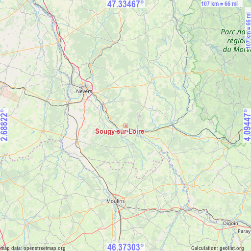
Sougy-sur-Loire GPS coordinates[2]
46° 51' 21.6" North, 3° 23' 28.824" East
| Map corner | latitude | longitude |
|---|---|---|
| Upper-left | 47.33467°, | 2.68822° |
| Center: | 46.856°, | 3.39134° |
| Lower-right: | 46.37303°, | 4.09447° |
| Map W x H: | 106.9×106.9 km | = 66.4×66.4mi |
| max Lat: | 51.07786° ⇑56.6% North |
| Sougy-sur-Loire: | 46.856° |
| min Lat: | ⇓43.4% South 41.3874° |
| min Long | Sougy-sur-Loire | max Long |
| -5.08615° | 3.39134° | 9.52242° |
| W 63.1%⇐ | ⇒36.9% E |
Elevation
Elevation of Sougy-sur-Loire is 221 m = 725 ft, and this is 27.3 m = 90 ft above average elevation for this country.
| Max E: |
2333 m = 7654 ft | 29.6% |
| Sougy-sur-Loire | 221 m 725 ft | |
| Avg. | 193.7 m = 635 ft | |
Min E: |
-1 m = -3 ft | 70.4% |
See also: France elevation on elevation.city.
Geographical zone
Sougy-sur-Loire is located in North temperate zone (between Tropic of Cancer and the Arctic Circle). Distance of this North polar circle is 2191.3 km =1361.6 mi to North.| Distance of | km | miles | from Sougy-sur-Loire |
|---|---|---|---|
| North Pole | 4797.2 | 2980.8 | to North |
| Arctic Circle | 2191.3 | 1361.6 | to North |
| Tropic Cancer | 2604 | 1618.1 | to South |
| Equator | 5209.9 | 3237.3 | to South |


Nearby cities:
15 places around Sougy-sur-Loire: (largest is in red/bold)
• Champvert
9.2 km =5.7 mi,  100°
100°
• Charrin
17.5 km =10.9 mi,  115°
115°
• Chevenon
14.2 km =8.8 mi,  300°
300°
• Cossaye
13.9 km =8.6 mi,  149°
149°
• Decize
6.2 km =3.9 mi, 119°
• Dornes
15.8 km =9.8 mi,  190°
190°
• Imphy
13.4 km =8.3 mi,  311°
311°
• La Fermeté
13.1 km =8.1 mi,  340°
340°
• La Machine
6.9 km =4.3 mi,  53°
53°
• Luthenay-Uxeloup
9.6 km =6 mi,  266°
266°
• Saint-Benin-d’Azy
15.9 km =9.9 mi,  0°
0°
• Saint-Léger-des-Vignes
5.1 km =3.2 mi,  109°
109°
• Saint-Parize-le-Châtel
15.9 km =9.9 mi, 269°
• Saint-Éloi
18.3 km =11.4 mi,  315°
315°
• Sauvigny-les-Bois
15.3 km =9.5 mi, 323°
Sources, notices
• [Note1] Compared only with cities in France existing in our database
• [Src1] Map data: © OpenStreetMap contributors (CC-BY-SA)
• [Src2] Other city data from geonames.org with taken over terms of usage.
• [Src3] Geographical zone / Annual Mean Temperature by Robert A. Rohde @ Wikipedia
