Mouroux geodata
Mouroux (Île-de-France) is a populated place; located in France in Europe/Paris (GMT+2) time zone. With population of 4,604 people, there are 2145 cities with bigger population in this country. Compared to other cities in France, 76% of cities are located further ↓South; 58.3% of cities are located further ←West and 71% of cities have higher elevation than Mouroux. Note1
Administrative division(s):
- Level 1: Île-de-France
- Level 2: Seine-et-Marne
- Level 3: Arrondissement de Meaux
- Level 4: Mouroux


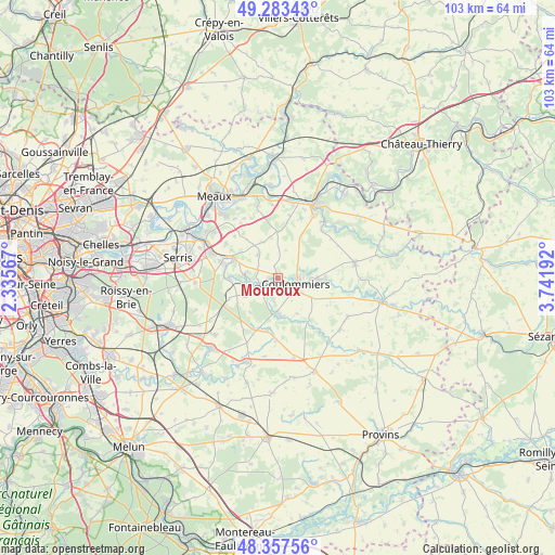
Mouroux GPS coordinates[2]
48° 49' 21.468" North, 3° 2' 19.644" East
| Map corner | latitude | longitude |
|---|---|---|
| Upper-left | 49.28343°, | 2.33567° |
| Center: | 48.82263°, | 3.03879° |
| Lower-right: | 48.35756°, | 3.74192° |
| Map W x H: | 102.9×102.9 km | = 63.9×63.9mi |
| max Lat: | 51.07786° ⇑24% North |
| Mouroux: | 48.82263° |
| min Lat: | ⇓76% South 41.3874° |
| min Long | Mouroux | max Long |
| -5.08615° | 3.03879° | 9.52242° |
| W 58.3%⇐ | ⇒41.7% E |
Elevation
Elevation of Mouroux is 76 m = 249 ft, and this is 117.7 m = 386 ft below average elevation for this country.
| Max E: |
2333 m = 7654 ft | 71% |
| Avg. | 193.7 m = 635 ft | |
| Mouroux | 76 m = 249 ft | |
Min E: |
-1 m = -3 ft | 29% |
See also: France elevation on elevation.city.
Geographical zone
Mouroux is located in North temperate zone (between Tropic of Cancer and the Arctic Circle). Distance of this North polar circle is 1972.6 km =1225.7 mi to North.| Distance of | km | miles | from Mouroux |
|---|---|---|---|
| North Pole | 4578.5 | 2844.9 | to North |
| Arctic Circle | 1972.6 | 1225.7 | to North |
| Tropic Cancer | 2822.6 | 1753.9 | to South |
| Equator | 5428.6 | 3373.2 | to South |


Nearby cities:
15 places around Mouroux: (largest is in red/bold)
• Beautheil
7.5 km =4.7 mi,  151°
151°
• Boissy-le-Châtel
7.2 km =4.5 mi,  91°
91°
• Chailly-en-Brie
7.2 km =4.5 mi,  119°
119°
• Coulommiers
3.5 km =2.2 mi,  104°
104°
• Dammartin-sur-Tigeaux
8.8 km =5.5 mi,  267°
267°
• Faremoutiers
4 km =2.5 mi,  230°
230°
• Guérard
5.8 km =3.6 mi, 268°
• La Celle-sur-Morin
5.2 km =3.2 mi,  256°
256°
• La Chapelle-sur-Crécy
9.2 km =5.7 mi,  295°
295°
• Maisoncelles-en-Brie
5.9 km =3.7 mi,  324°
324°
• Mortcerf
9.7 km =6 mi,  247°
247°
• Pommeuse
1.7 km =1.1 mi, 247°
• Saint-Augustin
4.4 km =2.7 mi,  188°
188°
• Saints
6.9 km =4.3 mi,  175°
175°
• Touquin
9.9 km =6.2 mi, 191°
Sources, notices
• [Note1] Compared only with cities in France existing in our database
• [Src1] Map data: © OpenStreetMap contributors (CC-BY-SA)
• [Src2] Other city data from geonames.org with taken over terms of usage.
• [Src3] Geographical zone / Annual Mean Temperature by Robert A. Rohde @ Wikipedia
