Saint-Aubin geodata
Saint-Aubin (Grand Est) is a populated place; located in France in Europe/Paris (GMT+2) time zone. With population of 558 people, there are 14045 cities with bigger population in this country. Compared to other cities in France, 67.8% of cities are located further ↓South; 64.7% of cities are located further ←West and 72.3% of cities have higher elevation than Saint-Aubin. Note1
Administrative division(s):
- Level 1: Grand Est
- Level 2: Département de l'Aube
- Level 3: Arrondissement de Nogent-sur-Seine
- Level 4: Saint-Aubin


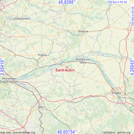
Saint-Aubin GPS coordinates[2]
48° 28' 32.916" North, 3° 33' 26.28" East
| Map corner | latitude | longitude |
|---|---|---|
| Upper-left | 48.9398°, | 2.85418° |
| Center: | 48.47581°, | 3.5573° |
| Lower-right: | 48.00754°, | 4.26043° |
| Map W x H: | 103.7×103.7 km | = 64.4×64.4mi |
| max Lat: | 51.07786° ⇑32.2% North |
| Saint-Aubin: | 48.47581° |
| min Lat: | ⇓67.8% South 41.3874° |
| min Long | Saint-Aubin | max Long |
| -5.08615° | 3.5573° | 9.52242° |
| W 64.7%⇐ | ⇒35.3% E |
Elevation
Elevation of Saint-Aubin is 73 m = 240 ft, and this is 120.7 m = 396 ft below average elevation for this country.
| Max E: |
2333 m = 7654 ft | 72.3% |
| Avg. | 193.7 m = 635 ft | |
| Saint-Aubin | 73 m = 240 ft | |
Min E: |
-1 m = -3 ft | 27.7% |
See also: France elevation on elevation.city.
Geographical zone
Saint-Aubin is located in North temperate zone (between Tropic of Cancer and the Arctic Circle). Distance of this North polar circle is 2011.2 km =1249.7 mi to North.| Distance of | km | miles | from Saint-Aubin |
|---|---|---|---|
| North Pole | 4617.1 | 2868.9 | to North |
| Arctic Circle | 2011.2 | 1249.7 | to North |
| Tropic Cancer | 2784.1 | 1730 | to South |
| Equator | 5390 | 3349.2 | to South |


Nearby cities:
15 places around Saint-Aubin: (largest is in red/bold)
• Chalautre-la-Grande
10.2 km =6.3 mi,  315°
315°
• Conflans-sur-Seine
12.4 km =7.7 mi,  46°
46°
• Crancey
7.5 km =4.7 mi, 52°
• Esclavolles-Lurey
11.2 km =7 mi,  40°
40°
• Fontaine-Fourches
14.1 km =8.8 mi,  240°
240°
• Gélannes
8.6 km =5.3 mi,  83°
83°
• Le Plessis-Mériot
9.8 km =6.1 mi,  296°
296°
• Marcilly-sur-Seine
14.4 km =8.9 mi, 50°
• Nogent-sur-Seine
4.5 km =2.8 mi, 296°
• Ossey-les-Trois-Maisons
14.3 km =8.9 mi,  108°
108°
• Pars-lès-Romilly
12.8 km =8 mi, 84°
• Pont-sur-Seine
5.5 km =3.4 mi,  31°
31°
• Romilly-sur-Seine
13.1 km =8.1 mi,  72°
72°
• Traînel
10.3 km =6.4 mi,  230°
230°
• Villenauxe-la-Grande
12 km =7.5 mi,  357°
357°
Sources, notices
• [Note1] Compared only with cities in France existing in our database
• [Src1] Map data: © OpenStreetMap contributors (CC-BY-SA)
• [Src2] Other city data from geonames.org with taken over terms of usage.
• [Src3] Geographical zone / Annual Mean Temperature by Robert A. Rohde @ Wikipedia
