Nogent-sur-Seine geodata
Nogent-sur-Seine (Grand Est) is a seat of a third-order administrative division; located in France in Europe/Paris (GMT+2) time zone. With population of 6,071 people, there are 1627 cities with bigger population in this country. Compared to other cities in France, 68.2% of cities are located further ↓South; 64.3% of cities are located further ←West and 71.4% of cities have higher elevation than Nogent-sur-Seine. Note1
Administrative division(s):
- Level 1: Grand Est
- Level 2: Département de l'Aube
- Level 3: Arrondissement de Nogent-sur-Seine
- Level 4: Nogent-sur-Seine


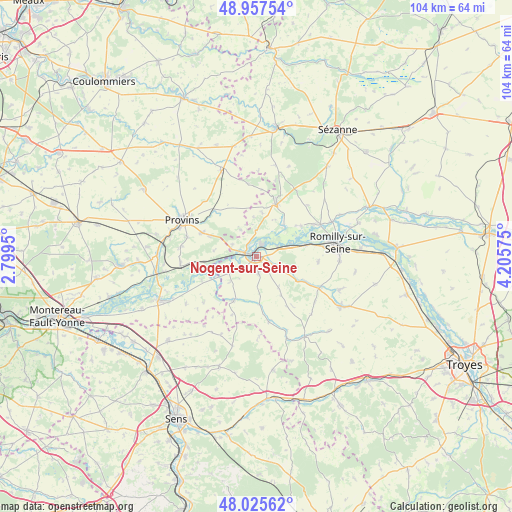
Nogent-sur-Seine GPS coordinates[2]
48° 29' 37.392" North, 3° 30' 9.432" East
| Map corner | latitude | longitude |
|---|---|---|
| Upper-left | 48.95754°, | 2.7995° |
| Center: | 48.49372°, | 3.50262° |
| Lower-right: | 48.02562°, | 4.20575° |
| Map W x H: | 103.6×103.6 km | = 64.4×64.4mi |
| max Lat: | 51.07786° ⇑31.8% North |
| Nogent-sur-Seine: | 48.49372° |
| min Lat: | ⇓68.2% South 41.3874° |
| min Long | Nogent-sur-Sein | max Long |
| -5.08615° | 3.50262° | 9.52242° |
| W 64.3%⇐ | ⇒35.7% E |
Elevation
Elevation of Nogent-sur-Seine is 75 m = 246 ft, and this is 118.7 m = 389 ft below average elevation for this country.
| Max E: |
2333 m = 7654 ft | 71.4% |
| Avg. | 193.7 m = 635 ft | |
| Nogent-sur-Seine | 75 m = 246 ft | |
Min E: |
-1 m = -3 ft | 28.6% |
See also: France elevation on elevation.city.
Geographical zone
Nogent-sur-Seine is located in North temperate zone (between Tropic of Cancer and the Arctic Circle). Distance of this North polar circle is 2009.2 km =1248.5 mi to North.| Distance of | km | miles | from Nogent-sur-Seine |
|---|---|---|---|
| North Pole | 4615.1 | 2867.7 | to North |
| Arctic Circle | 2009.2 | 1248.5 | to North |
| Tropic Cancer | 2786.1 | 1731.2 | to South |
| Equator | 5392 | 3350.4 | to South |


Nearby cities:
15 places around Nogent-sur-Seine: (largest is in red/bold)
• Chalautre-la-Grande
6.2 km =3.9 mi,  329°
329°
• Chalautre-la-Petite
14.6 km =9.1 mi,  285°
285°
• Conflans-sur-Seine
14.6 km =9.1 mi,  63°
63°
• Crancey
10.3 km =6.4 mi,  75°
75°
• Esclavolles-Lurey
13.1 km =8.1 mi, 59°
• Fontaine-Fourches
12.1 km =7.5 mi,  223°
223°
• Gélannes
12.6 km =7.8 mi,  94°
94°
• Hermé
11.6 km =7.2 mi,  264°
264°
• Le Plessis-Mériot
5.3 km =3.3 mi,  296°
296°
• Léchelle
12.6 km =7.8 mi,  318°
318°
• Pont-sur-Seine
7.4 km =4.6 mi,  68°
68°
• Saint-Aubin
4.5 km =2.8 mi,  116°
116°
• Sourdun
12.1 km =7.5 mi, 293°
• Traînel
9.4 km =5.8 mi,  204°
204°
• Villenauxe-la-Grande
10.6 km =6.6 mi,  19°
19°
Sources, notices
• [Note1] Compared only with cities in France existing in our database
• [Src1] Map data: © OpenStreetMap contributors (CC-BY-SA)
• [Src2] Other city data from geonames.org with taken over terms of usage.
• [Src3] Geographical zone / Annual Mean Temperature by Robert A. Rohde @ Wikipedia
