Rurange-lès-Thionville geodata
Rurange-lès-Thionville (Grand Est) is a populated place; located in France in Europe/Paris (GMT+2) time zone. With population of 1,680 people, there are 5577 cities with bigger population in this country. Compared to other cities in France, 85.6% of cities are located further ↓South; 89.6% of cities are located further ←West and 67.2% of cities have lower elevation than Rurange-lès-Thionville. Note1
Administrative division(s):
- Level 1: Grand Est
- Level 2: Moselle
- Level 3: Arrondissement de Thionville
- Level 4: Rurange-lès-Thionville
Current local time in Rurange-lès-Thionville:
05:51 AM, WednesdayDifference from your time zone: hours


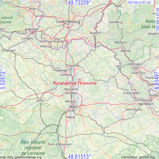
Rurange-lès-Thionville GPS coordinates[2]
49° 16' 33.564" North, 6° 13' 54.624" East
| Map corner | latitude | longitude |
|---|---|---|
| Upper-left | 49.73259°, | 5.52872° |
| Center: | 49.27599°, | 6.23184° |
| Lower-right: | 48.81513°, | 6.93497° |
| Map W x H: | 102×102 km | = 63.4×63.4mi |
| max Lat: | 51.07786° ⇑14.4% North |
| Rurange-lès-Thionville: | 49.27599° |
| min Lat: | ⇓85.6% South 41.3874° |
| min Long | Rurange-lès-Th | max Long |
| -5.08615° | 6.23184° | 9.52242° |
| W 89.6%⇐ | ⇒10.4% E |
Elevation
Elevation of Rurange-lès-Thionville is 205 m = 673 ft, and this is 11.3 m = 37 ft above average elevation for this country.
| Max E: |
2333 m = 7654 ft | 32.8% |
| Rurange-lès-Thionville | 205 m 673 ft | |
| Avg. | 193.7 m = 635 ft | |
Min E: |
-1 m = -3 ft | 67.2% |
See also: France elevation on elevation.city.
Geographical zone
Rurange-lès-Thionville is located in North temperate zone (between Tropic of Cancer and the Arctic Circle). Distance of this North polar circle is 1922.2 km =1194.4 mi to North.| Distance of | km | miles | from Rurange-lès-Thionville |
|---|---|---|---|
| North Pole | 4528.1 | 2813.6 | to North |
| Arctic Circle | 1922.2 | 1194.4 | to North |
| Tropic Cancer | 2873.1 | 1785.3 | to South |
| Equator | 5479 | 3404.5 | to South |


Nearby cities:
15 places around Rurange-lès-Thionville: (largest is in red/bold)
• Ay-sur-Moselle
4.1 km =2.5 mi,  207°
207°
• Bertrange
5.1 km =3.2 mi,  325°
325°
• Bousse
2.6 km =1.6 mi,  274°
274°
• Ennery
5.6 km =3.5 mi,  190°
190°
• Flévy
4.4 km =2.7 mi,  167°
167°
• Guénange
3.2 km =2 mi,  323°
323°
• Hagondange
5.8 km =3.6 mi,  238°
238°
• Luttange
5.8 km =3.6 mi,  96°
96°
• Metzeresche
6 km =3.7 mi,  64°
64°
• Metzervisse
5.7 km =3.5 mi,  40°
40°
• Mondelange
5.1 km =3.2 mi,  251°
251°
• Richemont
4.9 km =3 mi, 271°
• Stuckange
5.6 km =3.5 mi,  4°
4°
• Trémery
3.4 km =2.1 mi, 190°
• Volstroff
4.4 km =2.7 mi,  27°
27°
Sources, notices
• [Note1] Compared only with cities in France existing in our database
• [Src1] Map data: © OpenStreetMap contributors (CC-BY-SA)
• [Src2] Other city data from geonames.org with taken over terms of usage.
• [Src3] Geographical zone / Annual Mean Temperature by Robert A. Rohde @ Wikipedia
