Metzeresche geodata
Metzeresche (Grand Est) is a populated place; located in France in Europe/Paris (GMT+2) time zone. With population of 708 people, there are 11684 cities with bigger population in this country. Compared to other cities in France, 86% of cities are located further ↓South; 90.2% of cities are located further ←West and 69.8% of cities have lower elevation than Metzeresche. Note1
Administrative division(s):
- Level 1: Grand Est
- Level 2: Moselle
- Level 3: Arrondissement de Thionville
- Level 4: Metzeresche


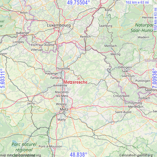
Metzeresche GPS coordinates[2]
49° 17' 55.14" North, 6° 18' 22.428" East
| Map corner | latitude | longitude |
|---|---|---|
| Upper-left | 49.75504°, | 5.60311° |
| Center: | 49.29865°, | 6.30623° |
| Lower-right: | 48.838°, | 7.00936° |
| Map W x H: | 102×102 km | = 63.4×63.4mi |
| max Lat: | 51.07786° ⇑14% North |
| Metzeresche: | 49.29865° |
| min Lat: | ⇓86% South 41.3874° |
| min Long | Metzeresche | max Long |
| -5.08615° | 6.30623° | 9.52242° |
| W 90.2%⇐ | ⇒9.8% E |
Elevation
Elevation of Metzeresche is 218 m = 715 ft, and this is 24.3 m = 80 ft above average elevation for this country.
| Max E: |
2333 m = 7654 ft | 30.2% |
| Metzeresche | 218 m 715 ft | |
| Avg. | 193.7 m = 635 ft | |
Min E: |
-1 m = -3 ft | 69.8% |
See also: France elevation on elevation.city.
Geographical zone
Metzeresche is located in North temperate zone (between Tropic of Cancer and the Arctic Circle). Distance of this North polar circle is 1919.7 km =1192.8 mi to North.| Distance of | km | miles | from Metzeresche |
|---|---|---|---|
| North Pole | 4525.6 | 2812.1 | to North |
| Arctic Circle | 1919.7 | 1192.8 | to North |
| Tropic Cancer | 2875.6 | 1786.8 | to South |
| Equator | 5481.5 | 3406 | to South |


Nearby cities:
15 places around Metzeresche: (largest is in red/bold)
• Bettelainville
7.1 km =4.4 mi,  183°
183°
• Distroff
4.8 km =3 mi,  323°
323°
• Elzange
7.2 km =4.5 mi,  348°
348°
• Flévy
8.1 km =5 mi,  213°
213°
• Guénange
7.3 km =4.5 mi,  270°
270°
• Hombourg
2.6 km =1.6 mi,  93°
93°
• Kuntzig
7.4 km =4.6 mi, 317°
• Kédange-sur-Canner
2.6 km =1.6 mi,  63°
63°
• Luttange
3.1 km =1.9 mi,  173°
173°
• Metzervisse
2.5 km =1.6 mi, 316°
• Rurange-lès-Thionville
6 km =3.7 mi,  244°
244°
• Stuckange
5.8 km =3.6 mi,  302°
302°
• Veckring
6.7 km =4.2 mi,  49°
49°
• Volstroff
3.7 km =2.3 mi,  292°
292°
• Ébersviller
7.4 km =4.6 mi,  110°
110°
Sources, notices
• [Note1] Compared only with cities in France existing in our database
• [Src1] Map data: © OpenStreetMap contributors (CC-BY-SA)
• [Src2] Other city data from geonames.org with taken over terms of usage.
• [Src3] Geographical zone / Annual Mean Temperature by Robert A. Rohde @ Wikipedia
