Ennery geodata
Ennery (Grand Est) is a populated place; located in France in Europe/Paris (GMT+2) time zone. With population of 1,804 people, there are 5261 cities with bigger population in this country. Compared to other cities in France, 84.7% of cities are located further ↓South; 89.5% of cities are located further ←West and 60% of cities have lower elevation than Ennery. Note1
Administrative division(s):
- Level 1: Grand Est
- Level 2: Moselle
- Level 3: Arrondissement de Metz
- Level 4: Ennery


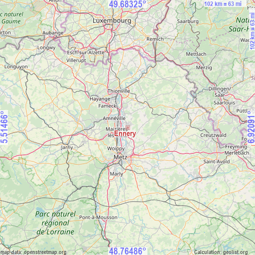
Ennery GPS coordinates[2]
49° 13' 34.284" North, 6° 13' 4.008" East
| Map corner | latitude | longitude |
|---|---|---|
| Upper-left | 49.68325°, | 5.51466° |
| Center: | 49.22619°, | 6.21778° |
| Lower-right: | 48.76486°, | 6.92091° |
| Map W x H: | 102.1×102.1 km | = 63.4×63.4mi |
| max Lat: | 51.07786° ⇑15.3% North |
| Ennery: | 49.22619° |
| min Lat: | ⇓84.7% South 41.3874° |
| min Long | Ennery | max Long |
| -5.08615° | 6.21778° | 9.52242° |
| W 89.5%⇐ | ⇒10.5% E |
Elevation
Elevation of Ennery is 170 m = 558 ft, and this is 23.7 m = 78 ft below average elevation for this country.
| Max E: |
2333 m = 7654 ft | 40% |
| Avg. | 193.7 m = 635 ft | |
| Ennery | 170 m = 558 ft | |
Min E: |
-1 m = -3 ft | 60% |
See also: France elevation on elevation.city.
Geographical zone
Ennery is located in North temperate zone (between Tropic of Cancer and the Arctic Circle). Distance of this North polar circle is 1927.7 km =1197.8 mi to North.| Distance of | km | miles | from Ennery |
|---|---|---|---|
| North Pole | 4533.6 | 2817 | to North |
| Arctic Circle | 1927.7 | 1197.8 | to North |
| Tropic Cancer | 2867.5 | 1781.8 | to South |
| Equator | 5473.4 | 3401 | to South |


Nearby cities:
15 places around Ennery: (largest is in red/bold)
• Argancy
3.6 km =2.2 mi,  198°
198°
• Ay-sur-Moselle
2.1 km =1.3 mi,  336°
336°
• Bettelainville
6.1 km =3.8 mi,  80°
80°
• Bousse
5.9 km =3.7 mi,  345°
345°
• Charly-Oradour
6 km =3.7 mi,  165°
165°
• Flévy
2.3 km =1.4 mi,  57°
57°
• Hagondange
4.7 km =2.9 mi,  302°
302°
• Hauconcourt
2.2 km =1.4 mi,  248°
248°
• Maizières-lès-Metz
4.5 km =2.8 mi, 251°
• Mondelange
5.5 km =3.4 mi,  315°
315°
• Rurange-lès-Thionville
5.6 km =3.5 mi,  10°
10°
• Sanry-lès-Vigy
6.6 km =4.1 mi,  137°
137°
• Talange
3.5 km =2.2 mi,  287°
287°
• Trémery
2.3 km =1.4 mi, 10°
• Vigy
6.4 km =4 mi,  112°
112°
Sources, notices
• [Note1] Compared only with cities in France existing in our database
• [Src1] Map data: © OpenStreetMap contributors (CC-BY-SA)
• [Src2] Other city data from geonames.org with taken over terms of usage.
• [Src3] Geographical zone / Annual Mean Temperature by Robert A. Rohde @ Wikipedia
