Volstroff geodata
Volstroff (Grand Est) is a populated place; located in France in Europe/Paris (GMT+2) time zone. With population of 1,510 people, there are 6158 cities with bigger population in this country. Compared to other cities in France, 86.3% of cities are located further ↓South; 89.8% of cities are located further ←West and 64.4% of cities have lower elevation than Volstroff. Note1
Administrative division(s):
- Level 1: Grand Est
- Level 2: Moselle
- Level 3: Arrondissement de Thionville
- Level 4: Volstroff


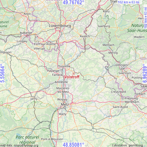
Volstroff GPS coordinates[2]
49° 18' 40.86" North, 6° 15' 35.136" East
| Map corner | latitude | longitude |
|---|---|---|
| Upper-left | 49.76762°, | 5.55664° |
| Center: | 49.31135°, | 6.25976° |
| Lower-right: | 48.85081°, | 6.96289° |
| Map W x H: | 101.9×101.9 km | = 63.3×63.3mi |
| max Lat: | 51.07786° ⇑13.7% North |
| Volstroff: | 49.31135° |
| min Lat: | ⇓86.3% South 41.3874° |
| min Long | Volstroff | max Long |
| -5.08615° | 6.25976° | 9.52242° |
| W 89.8%⇐ | ⇒10.2% E |
Elevation
Elevation of Volstroff is 191 m = 627 ft, and this is 2.7 m = 9 ft below average elevation for this country.
| Max E: |
2333 m = 7654 ft | 35.6% |
| Avg. | 193.7 m = 635 ft | |
| Volstroff | 191 m = 627 ft | |
Min E: |
-1 m = -3 ft | 64.4% |
See also: France elevation on elevation.city.
Geographical zone
Volstroff is located in North temperate zone (between Tropic of Cancer and the Arctic Circle). Distance of this North polar circle is 1918.3 km =1192 mi to North.| Distance of | km | miles | from Volstroff |
|---|---|---|---|
| North Pole | 4524.2 | 2811.2 | to North |
| Arctic Circle | 1918.3 | 1192 | to North |
| Tropic Cancer | 2877 | 1787.7 | to South |
| Equator | 5482.9 | 3406.9 | to South |


Nearby cities:
15 places around Volstroff: (largest is in red/bold)
• Bertrange
4.9 km =3 mi,  273°
273°
• Bousse
5.9 km =3.7 mi,  230°
230°
• Distroff
2.5 km =1.6 mi,  11°
11°
• Elzange
6 km =3.7 mi,  18°
18°
• Guénange
4.2 km =2.6 mi,  251°
251°
• Hombourg
6.2 km =3.9 mi,  104°
104°
• Illange
6 km =3.7 mi,  285°
285°
• Kuntzig
4.3 km =2.7 mi,  337°
337°
• Kédange-sur-Canner
5.7 km =3.5 mi,  92°
92°
• Luttange
5.9 km =3.7 mi,  140°
140°
• Metzeresche
3.7 km =2.3 mi,  112°
112°
• Metzervisse
1.7 km =1.1 mi,  77°
77°
• Rurange-lès-Thionville
4.4 km =2.7 mi,  207°
207°
• Stuckange
2.3 km =1.4 mi,  317°
317°
• Yutz
6.9 km =4.3 mi, 315°
Sources, notices
• [Note1] Compared only with cities in France existing in our database
• [Src1] Map data: © OpenStreetMap contributors (CC-BY-SA)
• [Src2] Other city data from geonames.org with taken over terms of usage.
• [Src3] Geographical zone / Annual Mean Temperature by Robert A. Rohde @ Wikipedia
