Flévy geodata
Flévy (Grand Est) is a populated place; located in France in Europe/Paris (GMT+2) time zone. With population of 505 people, there are 15148 cities with bigger population in this country. Compared to other cities in France, 85% of cities are located further ↓South; 89.7% of cities are located further ←West and 67% of cities have lower elevation than Flévy. Note1
Administrative division(s):
- Level 1: Grand Est
- Level 2: Moselle
- Level 3: Arrondissement de Metz
- Level 4: Flévy


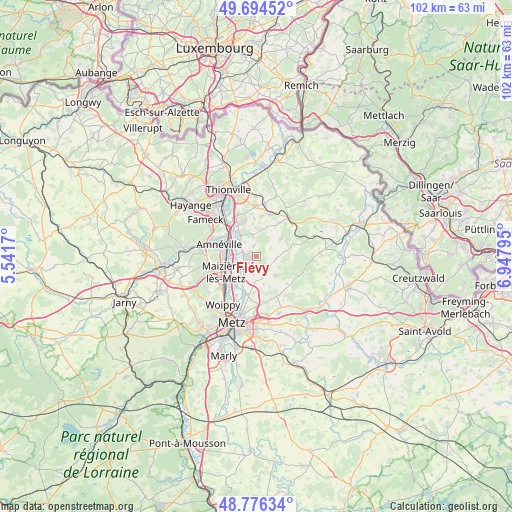
Flévy GPS coordinates[2]
49° 14' 15.216" North, 6° 14' 41.388" East
| Map corner | latitude | longitude |
|---|---|---|
| Upper-left | 49.69452°, | 5.5417° |
| Center: | 49.23756°, | 6.24483° |
| Lower-right: | 48.77634°, | 6.94795° |
| Map W x H: | 102.1×102.1 km | = 63.4×63.4mi |
| max Lat: | 51.07786° ⇑15% North |
| Flévy: | 49.23756° |
| min Lat: | ⇓85% South 41.3874° |
| min Long | Flévy | max Long |
| -5.08615° | 6.24483° | 9.52242° |
| W 89.7%⇐ | ⇒10.3% E |
Elevation
Elevation of Flévy is 204 m = 669 ft, and this is 10.3 m = 34 ft above average elevation for this country.
| Max E: |
2333 m = 7654 ft | 33% |
| Flévy | 204 m 669 ft | |
| Avg. | 193.7 m = 635 ft | |
Min E: |
-1 m = -3 ft | 67% |
See also: France elevation on elevation.city.
Geographical zone
Flévy is located in North temperate zone (between Tropic of Cancer and the Arctic Circle). Distance of this North polar circle is 1926.5 km =1197.1 mi to North.| Distance of | km | miles | from Flévy |
|---|---|---|---|
| North Pole | 4532.4 | 2816.3 | to North |
| Arctic Circle | 1926.5 | 1197.1 | to North |
| Tropic Cancer | 2868.8 | 1782.6 | to South |
| Equator | 5474.7 | 3401.8 | to South |


Nearby cities:
15 places around Flévy: (largest is in red/bold)
• Argancy
5.6 km =3.5 mi,  213°
213°
• Ay-sur-Moselle
2.9 km =1.8 mi,  282°
282°
• Bettelainville
4 km =2.5 mi,  93°
93°
• Bousse
5.7 km =3.5 mi,  322°
322°
• Ennery
2.3 km =1.4 mi,  237°
237°
• Hagondange
6 km =3.7 mi, 281°
• Hauconcourt
4.5 km =2.8 mi, 242°
• Luttange
6 km =3.7 mi,  52°
52°
• Maizières-lès-Metz
6.8 km =4.2 mi,  246°
246°
• Mondelange
6.4 km =4 mi,  294°
294°
• Rurange-lès-Thionville
4.4 km =2.7 mi,  347°
347°
• Sanry-lès-Vigy
6.6 km =4.1 mi,  157°
157°
• Talange
5.3 km =3.3 mi,  267°
267°
• Trémery
1.8 km =1.1 mi,  301°
301°
• Vigy
5.4 km =3.4 mi,  133°
133°
Sources, notices
• [Note1] Compared only with cities in France existing in our database
• [Src1] Map data: © OpenStreetMap contributors (CC-BY-SA)
• [Src2] Other city data from geonames.org with taken over terms of usage.
• [Src3] Geographical zone / Annual Mean Temperature by Robert A. Rohde @ Wikipedia
