Luttange geodata
Luttange (Grand Est) is a populated place; located in France in Europe/Paris (GMT+2) time zone. With population of 777 people, there are 10851 cities with bigger population in this country. Compared to other cities in France, 85.5% of cities are located further ↓South; 90.3% of cities are located further ←West and 78.4% of cities have lower elevation than Luttange. Note1
Administrative division(s):
- Level 1: Grand Est
- Level 2: Moselle
- Level 3: Arrondissement de Thionville
- Level 4: Luttange


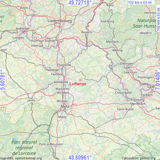
Luttange GPS coordinates[2]
49° 16' 13.908" North, 6° 18' 39.348" East
| Map corner | latitude | longitude |
|---|---|---|
| Upper-left | 49.72718°, | 5.60781° |
| Center: | 49.27053°, | 6.31093° |
| Lower-right: | 48.80961°, | 7.01406° |
| Map W x H: | 102×102 km | = 63.4×63.4mi |
| max Lat: | 51.07786° ⇑14.5% North |
| Luttange: | 49.27053° |
| min Lat: | ⇓85.5% South 41.3874° |
| min Long | Luttange | max Long |
| -5.08615° | 6.31093° | 9.52242° |
| W 90.3%⇐ | ⇒9.7% E |
Elevation
Elevation of Luttange is 275 m = 902 ft, and this is 81.3 m = 267 ft above average elevation for this country.
| Max E: |
2333 m = 7654 ft | 21.6% |
| Luttange | 275 m 902 ft | |
| Avg. | 193.7 m = 635 ft | |
Min E: |
-1 m = -3 ft | 78.4% |
See also: France elevation on elevation.city.
Geographical zone
Luttange is located in North temperate zone (between Tropic of Cancer and the Arctic Circle). Distance of this North polar circle is 1922.8 km =1194.8 mi to North.| Distance of | km | miles | from Luttange |
|---|---|---|---|
| North Pole | 4528.7 | 2814 | to North |
| Arctic Circle | 1922.8 | 1194.8 | to North |
| Tropic Cancer | 2872.5 | 1784.9 | to South |
| Equator | 5478.4 | 3404.1 | to South |


Nearby cities:
15 places around Luttange: (largest is in red/bold)
• Ay-sur-Moselle
8.2 km =5.1 mi,  248°
248°
• Bettelainville
4 km =2.5 mi,  191°
191°
• Distroff
7.6 km =4.7 mi,  335°
335°
• Flévy
6 km =3.7 mi,  232°
232°
• Hombourg
3.7 km =2.3 mi,  38°
38°
• Kédange-sur-Canner
4.7 km =2.9 mi,  24°
24°
• Metzeresche
3.1 km =1.9 mi,  353°
353°
• Metzervisse
5.3 km =3.3 mi, 337°
• Piblange
7.9 km =4.9 mi,  105°
105°
• Rurange-lès-Thionville
5.8 km =3.6 mi,  276°
276°
• Stuckange
8.2 km =5.1 mi,  319°
319°
• Trémery
6.9 km =4.3 mi, 246°
• Vigy
7.4 km =4.6 mi, 186°
• Volstroff
5.9 km =3.7 mi, 320°
• Ébersviller
6.6 km =4.1 mi,  85°
85°
Sources, notices
• [Note1] Compared only with cities in France existing in our database
• [Src1] Map data: © OpenStreetMap contributors (CC-BY-SA)
• [Src2] Other city data from geonames.org with taken over terms of usage.
• [Src3] Geographical zone / Annual Mean Temperature by Robert A. Rohde @ Wikipedia
