Aslonnes geodata
Aslonnes (Nouvelle-Aquitaine) is a populated place; located in France in Europe/Paris (GMT+2) time zone. With population of 931 people, there are 9375 cities with bigger population in this country. Compared to other cities in France, 61.1% of cities are located further ↑North; 75% of cities are located further →East and 61.2% of cities have higher elevation than Aslonnes. Note1
Administrative division(s):
- Level 1: Nouvelle-Aquitaine
- Level 2: Vienne
- Level 3: Arrondissement de Poitiers
- Level 4: Aslonnes


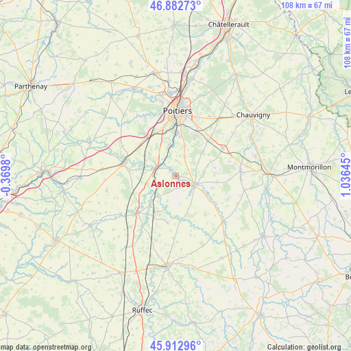
Aslonnes GPS coordinates[2]
46° 24' 0" North, 0° 19' 59.988" East
| Map corner | latitude | longitude |
|---|---|---|
| Upper-left | 46.88273°, | -0.3698° |
| Center: | 46.4°, | 0.33333° |
| Lower-right: | 45.91296°, | 1.03645° |
| Map W x H: | 107.8×107.8 km | = 67×67mi |
| max Lat: | 51.07786° ⇑61.1% North |
| Aslonnes: | 46.4° |
| min Lat: | ⇓38.9% South 41.3874° |
| min Long | Aslonnes | max Long |
| -5.08615° | 0.33333° | 9.52242° |
| W 25%⇐ | ⇒75% E |
Elevation
Elevation of Aslonnes is 99 m = 325 ft, and this is 94.7 m = 311 ft below average elevation for this country.
| Max E: |
2333 m = 7654 ft | 61.2% |
| Avg. | 193.7 m = 635 ft | |
| Aslonnes | 99 m = 325 ft | |
Min E: |
-1 m = -3 ft | 38.8% |
See also: France elevation on elevation.city.
Geographical zone
Aslonnes is located in North temperate zone (between Tropic of Cancer and the Arctic Circle). Distance of this North polar circle is 2242 km =1393.1 mi to North.| Distance of | km | miles | from Aslonnes |
|---|---|---|---|
| North Pole | 4847.9 | 3012.3 | to North |
| Arctic Circle | 2242 | 1393.1 | to North |
| Tropic Cancer | 2553.3 | 1586.5 | to South |
| Equator | 5159.2 | 3205.8 | to South |


Nearby cities:
15 places around Aslonnes: (largest is in red/bold)
• Ceaux-en-Couhé
12 km =7.5 mi,  219°
219°
• Celle-Lévescault
11.5 km =7.1 mi,  283°
283°
• Champagné-Saint-Hilaire
9 km =5.6 mi,  184°
184°
• Château-Larcher
2.4 km =1.5 mi,  322°
322°
• Iteuil
10 km =6.2 mi,  350°
350°
• La Villedieu-du-Clain
6.8 km =4.2 mi,  24°
24°
• Magné
6.7 km =4.2 mi,  136°
136°
• Marnay
0.8 km =0.5 mi,  123°
123°
• Marçay
10.7 km =6.6 mi,  310°
310°
• Payré
11.4 km =7.1 mi,  234°
234°
• Roches-Prémarie-Andillé
9.8 km =6.1 mi, 16°
• Saint-Maurice-la-Clouère
6.4 km =4 mi,  110°
110°
• Smarves
12.4 km =7.7 mi,  5°
5°
• Vernon
11.8 km =7.3 mi,  67°
67°
• Vivonne
6.3 km =3.9 mi,  302°
302°
Sources, notices
• [Note1] Compared only with cities in France existing in our database
• [Src1] Map data: © OpenStreetMap contributors (CC-BY-SA)
• [Src2] Other city data from geonames.org with taken over terms of usage.
• [Src3] Geographical zone / Annual Mean Temperature by Robert A. Rohde @ Wikipedia
