Rixheim geodata
Rixheim (Grand Est) is a populated place; located in France in Europe/Paris (GMT+2) time zone. With population of 13,608 people, there are 698 cities with bigger population in this country. Compared to other cities in France, 55% of cities are located further ↓South; 97.3% of cities are located further ←West and 73.7% of cities have lower elevation than Rixheim. Note1
Administrative division(s):
- Level 1: Grand Est
- Level 2: Haut-Rhin
- Level 3: Arrondissement de Mulhouse
- Level 4: Rixheim


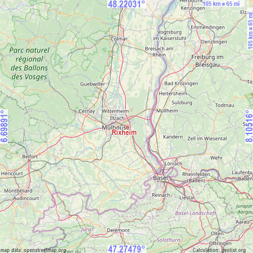
Rixheim GPS coordinates[2]
47° 44' 58.92" North, 7° 24' 7.308" East
| Map corner | latitude | longitude |
|---|---|---|
| Upper-left | 48.22031°, | 6.69891° |
| Center: | 47.7497°, | 7.40203° |
| Lower-right: | 47.27479°, | 8.10516° |
| Map W x H: | 105.1×105.1 km | = 65.3×65.3mi |
| max Lat: | 51.07786° ⇑45% North |
| Rixheim: | 47.7497° |
| min Lat: | ⇓55% South 41.3874° |
| min Long | Rixheim | max Long |
| -5.08615° | 7.40203° | 9.52242° |
| W 97.3%⇐ | ⇒2.7% E |
Elevation
Elevation of Rixheim is 240 m = 787 ft, and this is 46.3 m = 152 ft above average elevation for this country.
| Max E: |
2333 m = 7654 ft | 26.3% |
| Rixheim | 240 m 787 ft | |
| Avg. | 193.7 m = 635 ft | |
Min E: |
-1 m = -3 ft | 73.7% |
See also: France elevation on elevation.city.
Geographical zone
Rixheim is located in North temperate zone (between Tropic of Cancer and the Arctic Circle). Distance of this North polar circle is 2091.9 km =1299.8 mi to North.| Distance of | km | miles | from Rixheim |
|---|---|---|---|
| North Pole | 4697.8 | 2919.1 | to North |
| Arctic Circle | 2091.9 | 1299.8 | to North |
| Tropic Cancer | 2703.3 | 1679.8 | to South |
| Equator | 5309.3 | 3299 | to South |


Nearby cities:
15 places around Rixheim: (largest is in red/bold)
• Baldersheim
6 km =3.7 mi,  344°
344°
• Bruebach
6.3 km =3.9 mi,  210°
210°
• Brunstatt
6.9 km =4.3 mi,  242°
242°
• Dietwiller
6.3 km =3.9 mi,  179°
179°
• Eschentzwiller
4.1 km =2.5 mi, 184°
• Habsheim
2.5 km =1.6 mi,  151°
151°
• Illzach
4.6 km =2.9 mi,  305°
305°
• Kingersheim
7.3 km =4.5 mi, 309°
• Landser
7.2 km =4.5 mi,  187°
187°
• Mulhouse
5.5 km =3.4 mi,  272°
272°
• Pfastatt
7.7 km =4.8 mi,  286°
286°
• Riedisheim
2.6 km =1.6 mi, 266°
• Sausheim
4.7 km =2.9 mi,  332°
332°
• Schlierbach
7.4 km =4.6 mi, 176°
• Zimmersheim
3.4 km =2.1 mi,  197°
197°
Sources, notices
• [Note1] Compared only with cities in France existing in our database
• [Src1] Map data: © OpenStreetMap contributors (CC-BY-SA)
• [Src2] Other city data from geonames.org with taken over terms of usage.
• [Src3] Geographical zone / Annual Mean Temperature by Robert A. Rohde @ Wikipedia
