Baldersheim geodata
Baldersheim (Grand Est) is a populated place; located in France in Europe/Paris (GMT+2) time zone. With population of 2,318 people, there are 4164 cities with bigger population in this country. Compared to other cities in France, 55.8% of cities are located further ↓South; 97.1% of cities are located further ←West and 71.8% of cities have lower elevation than Baldersheim. Note1
Administrative division(s):
- Level 1: Grand Est
- Level 2: Haut-Rhin
- Level 3: Arrondissement de Mulhouse
- Level 4: Baldersheim


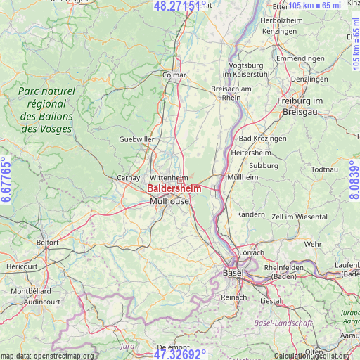
Baldersheim GPS coordinates[2]
47° 48' 4.896" North, 7° 22' 50.808" East
| Map corner | latitude | longitude |
|---|---|---|
| Upper-left | 48.27151°, | 6.67765° |
| Center: | 47.80136°, | 7.38078° |
| Lower-right: | 47.32692°, | 8.0839° |
| Map W x H: | 105×105 km | = 65.2×65.2mi |
| max Lat: | 51.07786° ⇑44.2% North |
| Baldersheim: | 47.80136° |
| min Lat: | ⇓55.8% South 41.3874° |
| min Long | Baldersheim | max Long |
| -5.08615° | 7.38078° | 9.52242° |
| W 97.1%⇐ | ⇒2.9% E |
Elevation
Elevation of Baldersheim is 229 m = 751 ft, and this is 35.3 m = 116 ft above average elevation for this country.
| Max E: |
2333 m = 7654 ft | 28.2% |
| Baldersheim | 229 m 751 ft | |
| Avg. | 193.7 m = 635 ft | |
Min E: |
-1 m = -3 ft | 71.8% |
See also: France elevation on elevation.city.
Geographical zone
Baldersheim is located in North temperate zone (between Tropic of Cancer and the Arctic Circle). Distance of this North polar circle is 2086.2 km =1296.3 mi to North.| Distance of | km | miles | from Baldersheim |
|---|---|---|---|
| North Pole | 4692 | 2915.5 | to North |
| Arctic Circle | 2086.2 | 1296.3 | to North |
| Tropic Cancer | 2709.1 | 1683.4 | to South |
| Equator | 5315 | 3302.6 | to South |


Nearby cities:
15 places around Baldersheim: (largest is in red/bold)
• Battenheim
2.1 km =1.3 mi,  1°
1°
• Ensisheim
7.5 km =4.7 mi,  342°
342°
• Habsheim
8.4 km =5.2 mi,  160°
160°
• Illzach
3.7 km =2.3 mi,  215°
215°
• Kingersheim
4.2 km =2.6 mi,  254°
254°
• Lutterbach
8.8 km =5.5 mi,  238°
238°
• Mulhouse
6.7 km =4.2 mi, 215°
• Pfastatt
6.8 km =4.2 mi, 238°
• Pulversheim
7.2 km =4.5 mi,  304°
304°
• Richwiller
7.8 km =4.8 mi, 252°
• Riedisheim
6 km =3.7 mi,  189°
189°
• Rixheim
6 km =3.7 mi, 164°
• Ruelisheim
3.1 km =1.9 mi,  325°
325°
• Sausheim
1.7 km =1.1 mi,  200°
200°
• Wittenheim
4.1 km =2.5 mi,  284°
284°
Sources, notices
• [Note1] Compared only with cities in France existing in our database
• [Src1] Map data: © OpenStreetMap contributors (CC-BY-SA)
• [Src2] Other city data from geonames.org with taken over terms of usage.
• [Src3] Geographical zone / Annual Mean Temperature by Robert A. Rohde @ Wikipedia
