Ribemont-sur-Ancre geodata
Ribemont-sur-Ancre (Hauts-de-France) is a populated place; located in France in Europe/Paris (GMT+2) time zone. With population of 623 people, there are 12932 cities with bigger population in this country. Compared to other cities in France, 93.3% of cities are located further ↓South; 51.6% of cities are located further ←West and 82.2% of cities have higher elevation than Ribemont-sur-Ancre. Note1
Administrative division(s):
- Level 1: Hauts-de-France
- Level 2: Somme
- Level 3: Amiens
- Level 4: Ribemont-sur-Ancre


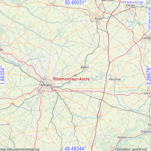
Ribemont-sur-Ancre GPS coordinates[2]
49° 57' 0" North, 2° 34' 0.012" East
| Map corner | latitude | longitude |
|---|---|---|
| Upper-left | 50.40031°, | 1.86354° |
| Center: | 49.95°, | 2.56667° |
| Lower-right: | 49.49544°, | 3.26979° |
| Map W x H: | 100.6×100.6 km | = 62.5×62.5mi |
| max Lat: | 51.07786° ⇑6.7% North |
| Ribemont-sur-Ancre: | 49.95° |
| min Lat: | ⇓93.3% South 41.3874° |
| min Long | Ribemont-sur-An | max Long |
| -5.08615° | 2.56667° | 9.52242° |
| W 51.6%⇐ | ⇒48.4% E |
Elevation
Elevation of Ribemont-sur-Ancre is 49 m = 161 ft, and this is 144.7 m = 475 ft below average elevation for this country.
| Max E: |
2333 m = 7654 ft | 82.2% |
| Avg. | 193.7 m = 635 ft | |
| Ribemont-sur-Ancre | 49 m = 161 ft | |
Min E: |
-1 m = -3 ft | 17.8% |
See also: France elevation on elevation.city.
Geographical zone
Ribemont-sur-Ancre is located in North temperate zone (between Tropic of Cancer and the Arctic Circle). Distance of this North polar circle is 1847.3 km =1147.9 mi to North.| Distance of | km | miles | from Ribemont-sur-Ancre |
|---|---|---|---|
| North Pole | 4453.1 | 2767 | to North |
| Arctic Circle | 1847.3 | 1147.9 | to North |
| Tropic Cancer | 2948 | 1831.8 | to South |
| Equator | 5553.9 | 3451 | to South |


Nearby cities:
15 places around Ribemont-sur-Ancre: (largest is in red/bold)
• Albert
8.3 km =5.2 mi,  46°
46°
• Aubigny
8.1 km =5 mi,  228°
228°
• Blangy-Tronville
13 km =8.1 mi, 232°
• Bouzincourt
9 km =5.6 mi,  20°
20°
• Bray-sur-Somme
10.9 km =6.8 mi,  95°
95°
• Corbie
6.4 km =4 mi,  221°
221°
• Daours
10.1 km =6.3 mi,  239°
239°
• Marcelcave
11.1 km =6.9 mi,  177°
177°
• Méaulte
7.6 km =4.7 mi,  62°
62°
• Pont-Noyelles
8.8 km =5.5 mi,  263°
263°
• Proyart
12.2 km =7.6 mi,  125°
125°
• Querrieu
9.8 km =6.1 mi, 262°
• Vecquemont
10 km =6.2 mi, 236°
• Villers-Bretonneux
9.7 km =6 mi,  201°
201°
• Warloy-Baillon
7.4 km =4.6 mi,  334°
334°
Sources, notices
• [Note1] Compared only with cities in France existing in our database
• [Src1] Map data: © OpenStreetMap contributors (CC-BY-SA)
• [Src2] Other city data from geonames.org with taken over terms of usage.
• [Src3] Geographical zone / Annual Mean Temperature by Robert A. Rohde @ Wikipedia
