Ouches geodata
Ouches (Auvergne-Rhône-Alpes) is a populated place; located in France in Europe/Paris (GMT+2) time zone. With population of 1,143 people, there are 7868 cities with bigger population in this country. Compared to other cities in France, 66.1% of cities are located further ↑North; 67.7% of cities are located further ←West and 83% of cities have lower elevation than Ouches. Note1
Administrative division(s):
- Level 1: Auvergne-Rhône-Alpes
- Level 2: Département de la Loire
- Level 3: Arrondissement de Roanne
- Level 4: Ouches


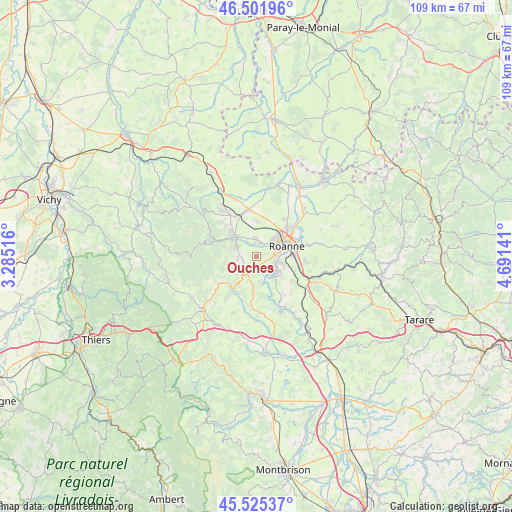
Ouches GPS coordinates[2]
46° 0' 56.952" North, 3° 59' 17.808" East
| Map corner | latitude | longitude |
|---|---|---|
| Upper-left | 46.50196°, | 3.28516° |
| Center: | 46.01582°, | 3.98828° |
| Lower-right: | 45.52537°, | 4.69141° |
| Map W x H: | 108.6×108.6 km | = 67.5×67.5mi |
| max Lat: | 51.07786° ⇑66.1% North |
| Ouches: | 46.01582° |
| min Lat: | ⇓33.9% South 41.3874° |
| min Long | Ouches | max Long |
| -5.08615° | 3.98828° | 9.52242° |
| W 67.7%⇐ | ⇒32.3% E |
Elevation
Elevation of Ouches is 321 m = 1053 ft, and this is 127.3 m = 418 ft above average elevation for this country.
| Max E: |
2333 m = 7654 ft | 17% |
| Ouches | 321 m 1053 ft | |
| Avg. | 193.7 m = 635 ft | |
Min E: |
-1 m = -3 ft | 83% |
See also: France elevation on elevation.city.
Geographical zone
Ouches is located in North temperate zone (between Tropic of Cancer and the Arctic Circle). Distance of this North polar circle is 2284.7 km =1419.6 mi to North.| Distance of | km | miles | from Ouches |
|---|---|---|---|
| North Pole | 4890.6 | 3038.9 | to North |
| Arctic Circle | 2284.7 | 1419.6 | to North |
| Tropic Cancer | 2510.6 | 1560 | to South |
| Equator | 5116.5 | 3179.2 | to South |


Nearby cities:
15 places around Ouches: (largest is in red/bold)
• Commelle
5.6 km =3.5 mi,  107°
107°
• Le Coteau
8 km =5 mi,  87°
87°
• Lentigny
2.5 km =1.6 mi,  196°
196°
• Mably
7.8 km =4.8 mi,  45°
45°
• Pouilly-les-Nonains
3.3 km =2.1 mi,  352°
352°
• Renaison
6.2 km =3.9 mi,  307°
307°
• Riorges
5.2 km =3.2 mi, 53°
• Roanne
6.6 km =4.1 mi,  69°
69°
• Saint-Alban-les-Eaux
3.3 km =2.1 mi,  261°
261°
• Saint-Haon-le-Châtel
7.7 km =4.8 mi, 314°
• Saint-Haon-le-Vieux
9.1 km =5.7 mi,  315°
315°
• Saint-Léger-sur-Roanne
3 km =1.9 mi,  12°
12°
• Saint-Romain-la-Motte
7.3 km =4.5 mi,  1°
1°
• Villemontais
4.6 km =2.9 mi,  213°
213°
• Villerest
4.2 km =2.6 mi,  122°
122°
Sources, notices
• [Note1] Compared only with cities in France existing in our database
• [Src1] Map data: © OpenStreetMap contributors (CC-BY-SA)
• [Src2] Other city data from geonames.org with taken over terms of usage.
• [Src3] Geographical zone / Annual Mean Temperature by Robert A. Rohde @ Wikipedia
