Loupershouse geodata
Loupershouse (Grand Est) is a populated place; located in France in Europe/Paris (GMT+2) time zone. With population of 924 people, there are 9438 cities with bigger population in this country. Compared to other cities in France, 81.7% of cities are located further ↓South; 94.3% of cities are located further ←West and 74.2% of cities have lower elevation than Loupershouse. Note1
Administrative division(s):
- Level 1: Grand Est
- Level 2: Moselle
- Level 3: Arrondissement de Sarreguemines
- Level 4: Loupershouse


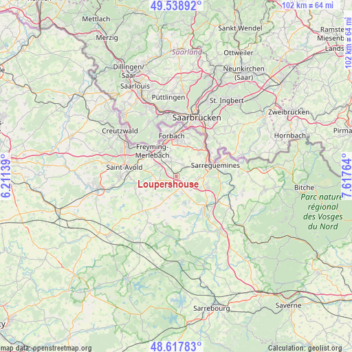
Loupershouse GPS coordinates[2]
49° 4' 49.836" North, 6° 54' 52.236" East
| Map corner | latitude | longitude |
|---|---|---|
| Upper-left | 49.53892°, | 6.21139° |
| Center: | 49.08051°, | 6.91451° |
| Lower-right: | 48.61783°, | 7.61764° |
| Map W x H: | 102.4×102.4 km | = 63.6×63.6mi |
| max Lat: | 51.07786° ⇑18.3% North |
| Loupershouse: | 49.08051° |
| min Lat: | ⇓81.7% South 41.3874° |
| min Long | Loupershouse | max Long |
| -5.08615° | 6.91451° | 9.52242° |
| W 94.3%⇐ | ⇒5.7% E |
Elevation
Elevation of Loupershouse is 243 m = 797 ft, and this is 49.3 m = 162 ft above average elevation for this country.
| Max E: |
2333 m = 7654 ft | 25.8% |
| Loupershouse | 243 m 797 ft | |
| Avg. | 193.7 m = 635 ft | |
Min E: |
-1 m = -3 ft | 74.2% |
See also: France elevation on elevation.city.
Geographical zone
Loupershouse is located in North temperate zone (between Tropic of Cancer and the Arctic Circle). Distance of this North polar circle is 1943.9 km =1207.9 mi to North.| Distance of | km | miles | from Loupershouse |
|---|---|---|---|
| North Pole | 4549.8 | 2827.1 | to North |
| Arctic Circle | 1943.9 | 1207.9 | to North |
| Tropic Cancer | 2851.3 | 1771.7 | to South |
| Equator | 5457.2 | 3390.9 | to South |


Nearby cities:
15 places around Loupershouse: (largest is in red/bold)
• Barst
6.1 km =3.8 mi,  257°
257°
• Cappel
4.9 km =3 mi, 259°
• Diebling
3.7 km =2.3 mi,  29°
29°
• Ernestviller
3.9 km =2.4 mi,  110°
110°
• Farschviller
2.1 km =1.3 mi,  316°
316°
• Farébersviller
5.4 km =3.4 mi, 322°
• Grundviller
5.8 km =3.6 mi,  133°
133°
• Henriville
4.7 km =2.9 mi,  294°
294°
• Hundling
5.7 km =3.5 mi,  56°
56°
• Metzing
4.2 km =2.6 mi,  48°
48°
• Nousseviller-Saint-Nabor
6 km =3.7 mi,  41°
41°
• Rémering-lès-Puttelange
5.2 km =3.2 mi,  160°
160°
• Saint-Jean-Rohrbach
6.4 km =4 mi,  199°
199°
• Tenteling
5.3 km =3.3 mi,  18°
18°
• Théding
5.6 km =3.5 mi,  343°
343°
Sources, notices
• [Note1] Compared only with cities in France existing in our database
• [Src1] Map data: © OpenStreetMap contributors (CC-BY-SA)
• [Src2] Other city data from geonames.org with taken over terms of usage.
• [Src3] Geographical zone / Annual Mean Temperature by Robert A. Rohde @ Wikipedia
