Saint-Jean-Rohrbach geodata
Saint-Jean-Rohrbach (Grand Est) is a populated place; located in France in Europe/Paris (GMT+2) time zone. With population of 986 people, there are 8936 cities with bigger population in this country. Compared to other cities in France, 80.3% of cities are located further ↓South; 94.2% of cities are located further ←West and 71.8% of cities have lower elevation than Saint-Jean-Rohrbach. Note1
Administrative division(s):
- Level 1: Grand Est
- Level 2: Moselle
- Level 3: Arrondissement de Sarreguemines
- Level 4: Saint-Jean-Rohrbach


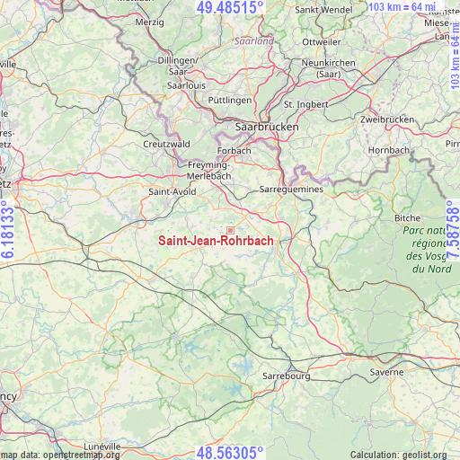
Saint-Jean-Rohrbach GPS coordinates[2]
49° 1' 34.464" North, 6° 53' 4.056" East
| Map corner | latitude | longitude |
|---|---|---|
| Upper-left | 49.48515°, | 6.18133° |
| Center: | 49.02624°, | 6.88446° |
| Lower-right: | 48.56305°, | 7.58758° |
| Map W x H: | 102.5×102.5 km | = 63.7×63.7mi |
| max Lat: | 51.07786° ⇑19.7% North |
| Saint-Jean-Rohrbach: | 49.02624° |
| min Lat: | ⇓80.3% South 41.3874° |
| min Long | Saint-Jean-Rohr | max Long |
| -5.08615° | 6.88446° | 9.52242° |
| W 94.2%⇐ | ⇒5.8% E |
Elevation
Elevation of Saint-Jean-Rohrbach is 229 m = 751 ft, and this is 35.3 m = 116 ft above average elevation for this country.
| Max E: |
2333 m = 7654 ft | 28.2% |
| Saint-Jean-Rohrbach | 229 m 751 ft | |
| Avg. | 193.7 m = 635 ft | |
Min E: |
-1 m = -3 ft | 71.8% |
See also: France elevation on elevation.city.
Geographical zone
Saint-Jean-Rohrbach is located in North temperate zone (between Tropic of Cancer and the Arctic Circle). Distance of this North polar circle is 1950 km =1211.7 mi to North.| Distance of | km | miles | from Saint-Jean-Rohrbach |
|---|---|---|---|
| North Pole | 4555.9 | 2830.9 | to North |
| Arctic Circle | 1950 | 1211.7 | to North |
| Tropic Cancer | 2845.3 | 1768 | to South |
| Equator | 5451.2 | 3387.2 | to South |


Nearby cities:
15 places around Saint-Jean-Rohrbach: (largest is in red/bold)
• Barst
6 km =3.7 mi,  321°
321°
• Cappel
5.8 km =3.6 mi,  332°
332°
• Ernestviller
7.5 km =4.7 mi,  51°
51°
• Farschviller
7.6 km =4.7 mi,  5°
5°
• Francaltroff
9.5 km =5.9 mi,  221°
221°
• Grundviller
6.7 km =4.2 mi,  72°
72°
• Hellimer
5.2 km =3.2 mi,  230°
230°
• Henriville
8.3 km =5.2 mi,  345°
345°
• Hilsprich
2.6 km =1.6 mi,  121°
121°
• Holving
6.1 km =3.8 mi,  105°
105°
• Insming
7.9 km =4.9 mi,  184°
184°
• Laning
8.1 km =5 mi,  277°
277°
• Le Val-de-Guéblange
7.6 km =4.7 mi,  131°
131°
• Loupershouse
6.4 km =4 mi,  19°
19°
• Rémering-lès-Puttelange
4.1 km =2.5 mi, 73°
Sources, notices
• [Note1] Compared only with cities in France existing in our database
• [Src1] Map data: © OpenStreetMap contributors (CC-BY-SA)
• [Src2] Other city data from geonames.org with taken over terms of usage.
• [Src3] Geographical zone / Annual Mean Temperature by Robert A. Rohde @ Wikipedia
