Reims geodata
Reims (Grand Est) is a seat of a third-order administrative division; located in France in Europe/Paris (GMT+2) time zone. With population of 196,565 people, there are 11 cities with bigger population in this country. Compared to other cities in France, 85.4% of cities are located further ↓South; 68.1% of cities are located further ←West and 64.9% of cities have higher elevation than Reims. Note1
Administrative division(s):
- Level 1: Grand Est
- Level 2: Marne
- Level 3: Arrondissement de Reims
- Level 4: Reims


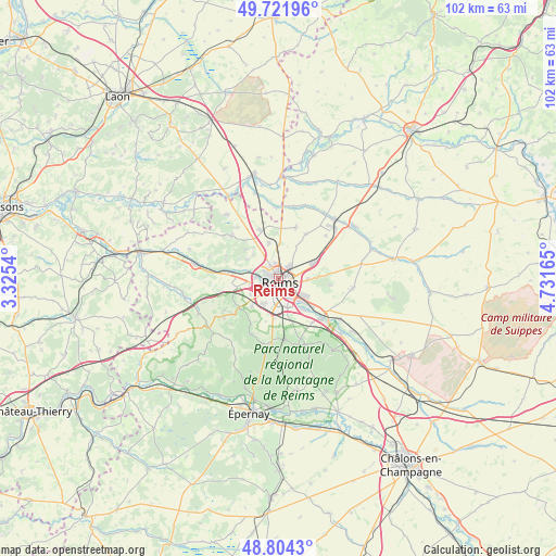
Reims GPS coordinates[2]
49° 15' 54.936" North, 4° 1' 42.708" East
| Map corner | latitude | longitude |
|---|---|---|
| Upper-left | 49.72196°, | 3.3254° |
| Center: | 49.26526°, | 4.02853° |
| Lower-right: | 48.8043°, | 4.73165° |
| Map W x H: | 102×102 km | = 63.4×63.4mi |
| max Lat: | 51.07786° ⇑14.6% North |
| Reims: | 49.26526° |
| min Lat: | ⇓85.4% South 41.3874° |
| min Long | Reims | max Long |
| -5.08615° | 4.02853° | 9.52242° |
| W 68.1%⇐ | ⇒31.9% E |
Elevation
Elevation of Reims is 90 m = 295 ft, and this is 103.7 m = 340 ft below average elevation for this country.
| Max E: |
2333 m = 7654 ft | 64.9% |
| Avg. | 193.7 m = 635 ft | |
| Reims | 90 m = 295 ft | |
Min E: |
-1 m = -3 ft | 35.1% |
See also: Reims elevation on elevation.city.
Geographical zone
Reims is located in North temperate zone (between Tropic of Cancer and the Arctic Circle). Distance of this North polar circle is 1923.4 km =1195.1 mi to North.| Distance of | km | miles | from Reims |
|---|---|---|---|
| North Pole | 4529.3 | 2814.4 | to North |
| Arctic Circle | 1923.4 | 1195.1 | to North |
| Tropic Cancer | 2871.9 | 1784.5 | to South |
| Equator | 5477.8 | 3403.7 | to South |


Nearby cities:
15 places around Reims: (largest is in red/bold)
• Bezannes
5.5 km =3.4 mi,  211°
211°
• Bétheny
2.9 km =1.8 mi,  41°
41°
• Cernay-lès-Reims
5.3 km =3.3 mi,  91°
91°
• Champigny
4.2 km =2.6 mi,  273°
273°
• Cormontreuil
5.6 km =3.5 mi,  163°
163°
• Courcy
6.8 km =4.2 mi,  343°
343°
• Gueux
8.7 km =5.4 mi,  259°
259°
• Les Mesneux
7.1 km =4.4 mi,  223°
223°
• Loivre
9.7 km =6 mi, 338°
• Merfy
6.7 km =4.2 mi,  301°
301°
• Saint-Brice-Courcelles
3.3 km =2.1 mi, 272°
• Saint-Thierry
6.4 km =4 mi,  314°
314°
• Taissy
7.3 km =4.5 mi,  139°
139°
• Tinqueux
3.7 km =2.3 mi,  242°
242°
• Witry-lès-Reims
7.2 km =4.5 mi,  65°
65°
Sources, notices
• [Note1] Compared only with cities in France existing in our database
• [Src1] Map data: © OpenStreetMap contributors (CC-BY-SA)
• [Src2] Other city data from geonames.org with taken over terms of usage.
• [Src3] Geographical zone / Annual Mean Temperature by Robert A. Rohde @ Wikipedia
