Bezannes geodata
Bezannes (Grand Est) is a populated place; located in France in Europe/Paris (GMT+2) time zone. With population of 1,286 people, there are 7096 cities with bigger population in this country. Compared to other cities in France, 84.7% of cities are located further ↓South; 67.7% of cities are located further ←West and 68.7% of cities have higher elevation than Bezannes. Note1
Administrative division(s):
- Level 1: Grand Est
- Level 2: Marne
- Level 3: Arrondissement de Reims
- Level 4: Bezannes


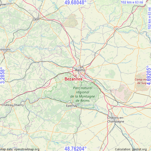
Bezannes GPS coordinates[2]
49° 13' 24.204" North, 3° 59' 20.112" East
| Map corner | latitude | longitude |
|---|---|---|
| Upper-left | 49.68048°, | 3.2858° |
| Center: | 49.22339°, | 3.98892° |
| Lower-right: | 48.76204°, | 4.69205° |
| Map W x H: | 102.1×102.1 km | = 63.4×63.4mi |
| max Lat: | 51.07786° ⇑15.3% North |
| Bezannes: | 49.22339° |
| min Lat: | ⇓84.7% South 41.3874° |
| min Long | Bezannes | max Long |
| -5.08615° | 3.98892° | 9.52242° |
| W 67.7%⇐ | ⇒32.3% E |
Elevation
Elevation of Bezannes is 81 m = 266 ft, and this is 112.7 m = 370 ft below average elevation for this country.
| Max E: |
2333 m = 7654 ft | 68.7% |
| Avg. | 193.7 m = 635 ft | |
| Bezannes | 81 m = 266 ft | |
Min E: |
-1 m = -3 ft | 31.3% |
See also: France elevation on elevation.city.
Geographical zone
Bezannes is located in North temperate zone (between Tropic of Cancer and the Arctic Circle). Distance of this North polar circle is 1928 km =1198 mi to North.| Distance of | km | miles | from Bezannes |
|---|---|---|---|
| North Pole | 4533.9 | 2817.2 | to North |
| Arctic Circle | 1928 | 1198 | to North |
| Tropic Cancer | 2867.2 | 1781.6 | to South |
| Equator | 5473.1 | 3400.8 | to South |


Nearby cities:
15 places around Bezannes: (largest is in red/bold)
• Bétheny
8.4 km =5.2 mi,  34°
34°
• Champigny
5.1 km =3.2 mi,  345°
345°
• Chigny-les-Roses
9.2 km =5.7 mi,  144°
144°
• Cormontreuil
4.5 km =2.8 mi,  99°
99°
• Gueux
6.5 km =4 mi,  297°
297°
• Les Mesneux
2 km =1.2 mi,  257°
257°
• Merfy
8.6 km =5.3 mi,  340°
340°
• Muizon
9.1 km =5.7 mi,  308°
308°
• Reims
5.5 km =3.4 mi, 31°
• Rilly-la-Montagne
7.6 km =4.7 mi,  147°
147°
• Saint-Brice-Courcelles
4.8 km =3 mi,  355°
355°
• Sermiers
7.2 km =4.5 mi,  182°
182°
• Taissy
7.7 km =4.8 mi, 96°
• Tinqueux
3 km =1.9 mi, 352°
• Villers-Allerand
7 km =4.3 mi,  157°
157°
Sources, notices
• [Note1] Compared only with cities in France existing in our database
• [Src1] Map data: © OpenStreetMap contributors (CC-BY-SA)
• [Src2] Other city data from geonames.org with taken over terms of usage.
• [Src3] Geographical zone / Annual Mean Temperature by Robert A. Rohde @ Wikipedia
