Bétheny geodata
Bétheny (Grand Est) is a populated place; located in France in Europe/Paris (GMT+2) time zone. With population of 6,002 people, there are 1650 cities with bigger population in this country. Compared to other cities in France, 85.8% of cities are located further ↓South; 68.4% of cities are located further ←West and 64.4% of cities have higher elevation than Bétheny. Note1
Administrative division(s):
- Level 1: Grand Est
- Level 2: Marne
- Level 3: Arrondissement de Reims
- Level 4: Bétheny


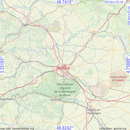
Bétheny GPS coordinates[2]
49° 17' 5.928" North, 4° 3' 17.82" East
| Map corner | latitude | longitude |
|---|---|---|
| Upper-left | 49.7415°, | 3.35183° |
| Center: | 49.28498°, | 4.05495° |
| Lower-right: | 48.8242°, | 4.75808° |
| Map W x H: | 102×102 km | = 63.4×63.4mi |
| max Lat: | 51.07786° ⇑14.2% North |
| Bétheny: | 49.28498° |
| min Lat: | ⇓85.8% South 41.3874° |
| min Long | Bétheny | max Long |
| -5.08615° | 4.05495° | 9.52242° |
| W 68.4%⇐ | ⇒31.6% E |
Elevation
Elevation of Bétheny is 91 m = 299 ft, and this is 102.7 m = 337 ft below average elevation for this country.
| Max E: |
2333 m = 7654 ft | 64.4% |
| Avg. | 193.7 m = 635 ft | |
| Bétheny | 91 m = 299 ft | |
Min E: |
-1 m = -3 ft | 35.6% |
See also: France elevation on elevation.city.
Geographical zone
Bétheny is located in North temperate zone (between Tropic of Cancer and the Arctic Circle). Distance of this North polar circle is 1921.2 km =1193.8 mi to North.| Distance of | km | miles | from Bétheny |
|---|---|---|---|
| North Pole | 4527.1 | 2813 | to North |
| Arctic Circle | 1921.2 | 1193.8 | to North |
| Tropic Cancer | 2874.1 | 1785.9 | to South |
| Equator | 5480 | 3405.1 | to South |


Nearby cities:
15 places around Bétheny: (largest is in red/bold)
• Bezannes
8.4 km =5.2 mi,  214°
214°
• Bourgogne
7.3 km =4.5 mi,  9°
9°
• Caurel
7.4 km =4.6 mi,  73°
73°
• Cernay-lès-Reims
4.2 km =2.6 mi,  124°
124°
• Champigny
6.4 km =4 mi,  252°
252°
• Cormontreuil
7.6 km =4.7 mi,  182°
182°
• Courcy
5.7 km =3.5 mi,  318°
318°
• Loivre
8.7 km =5.4 mi, 321°
• Merfy
7.7 km =4.8 mi,  279°
279°
• Reims
2.9 km =1.8 mi,  221°
221°
• Saint-Brice-Courcelles
5.6 km =3.5 mi, 248°
• Saint-Thierry
6.9 km =4.3 mi,  289°
289°
• Taissy
8.3 km =5.2 mi,  159°
159°
• Tinqueux
6.5 km =4 mi,  233°
233°
• Witry-lès-Reims
4.7 km =2.9 mi,  80°
80°
Sources, notices
• [Note1] Compared only with cities in France existing in our database
• [Src1] Map data: © OpenStreetMap contributors (CC-BY-SA)
• [Src2] Other city data from geonames.org with taken over terms of usage.
• [Src3] Geographical zone / Annual Mean Temperature by Robert A. Rohde @ Wikipedia
