Réchésy geodata
Réchésy (Bourgogne-Franche-Comté) is a populated place; located in France in Europe/Paris (GMT+2) time zone. With population of 784 people, there are 10781 cities with bigger population in this country. Compared to other cities in France, 51.4% of cities are located further ↓South; 95.3% of cities are located further ←West and 90.2% of cities have lower elevation than Réchésy. Note1
Administrative division(s):
- Level 1: Bourgogne-Franche-Comté
- Level 2: Territoire de Belfort
- Level 3: Arrondissement de Belfort
- Level 4: Réchésy


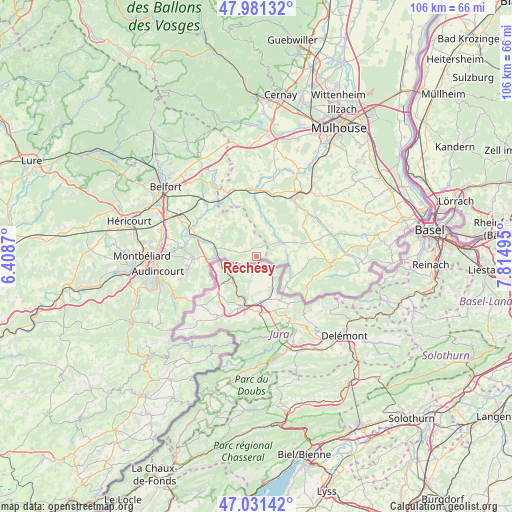
Réchésy GPS coordinates[2]
47° 30' 30.672" North, 7° 6' 42.552" East
| Map corner | latitude | longitude |
|---|---|---|
| Upper-left | 47.98132°, | 6.4087° |
| Center: | 47.50852°, | 7.11182° |
| Lower-right: | 47.03142°, | 7.81495° |
| Map W x H: | 105.6×105.6 km | = 65.6×65.6mi |
| max Lat: | 51.07786° ⇑48.6% North |
| Réchésy: | 47.50852° |
| min Lat: | ⇓51.4% South 41.3874° |
| min Long | Réchésy | max Long |
| -5.08615° | 7.11182° | 9.52242° |
| W 95.3%⇐ | ⇒4.7% E |
Elevation
Elevation of Réchésy is 430 m = 1411 ft, and this is 236.3 m = 775 ft above average elevation for this country.
| Max E: |
2333 m = 7654 ft | 9.8% |
| Réchésy | 430 m 1411 ft | |
| Avg. | 193.7 m = 635 ft | |
Min E: |
-1 m = -3 ft | 90.2% |
See also: France elevation on elevation.city.
Geographical zone
Réchésy is located in North temperate zone (between Tropic of Cancer and the Arctic Circle). Distance of this North polar circle is 2118.7 km =1316.5 mi to North.| Distance of | km | miles | from Réchésy |
|---|---|---|---|
| North Pole | 4724.6 | 2935.7 | to North |
| Arctic Circle | 2118.7 | 1316.5 | to North |
| Tropic Cancer | 2676.5 | 1663.1 | to South |
| Equator | 5282.5 | 3282.4 | to South |


Nearby cities:
15 places around Réchésy: (largest is in red/bold)
• Badevel
12.9 km =8 mi,  265°
265°
• Ballersdorf
13.3 km =8.3 mi,  16°
16°
• Bisel
8.5 km =5.3 mi,  69°
69°
• Dannemarie
13.6 km =8.5 mi,  2°
2°
• Delle
8.4 km =5.2 mi, 269°
• Durlinsdorf
10 km =6.2 mi,  104°
104°
• Friesen
6.9 km =4.3 mi, 24°
• Grandvillars
11.1 km =6.9 mi,  287°
287°
• Heimersdorf
12 km =7.5 mi,  53°
53°
• Hirtzbach
13 km =8.1 mi,  39°
39°
• Joncherey
8.5 km =5.3 mi, 285°
• Manspach
12.2 km =7.6 mi,  357°
357°
• Mœrnach
10.4 km =6.5 mi, 95°
• Pfetterhouse
4.1 km =2.5 mi, 101°
• Seppois-le-Bas
5.6 km =3.5 mi, 54°
Sources, notices
• [Note1] Compared only with cities in France existing in our database
• [Src1] Map data: © OpenStreetMap contributors (CC-BY-SA)
• [Src2] Other city data from geonames.org with taken over terms of usage.
• [Src3] Geographical zone / Annual Mean Temperature by Robert A. Rohde @ Wikipedia
