Hirtzbach geodata
Hirtzbach (Grand Est) is a populated place; located in France in Europe/Paris (GMT+2) time zone. With population of 1,239 people, there are 7334 cities with bigger population in this country. Compared to other cities in France, 52.6% of cities are located further ↓South; 95.9% of cities are located further ←West and 82.7% of cities have lower elevation than Hirtzbach. Note1
Administrative division(s):
- Level 1: Grand Est
- Level 2: Haut-Rhin
- Level 3: Altkirch
- Level 4: Hirtzbach


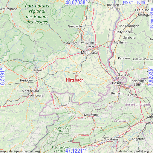
Hirtzbach GPS coordinates[2]
47° 35' 54.204" North, 7° 13' 19.992" East
| Map corner | latitude | longitude |
|---|---|---|
| Upper-left | 48.07038°, | 6.5191° |
| Center: | 47.59839°, | 7.22222° |
| Lower-right: | 47.12211°, | 7.92535° |
| Map W x H: | 105.4×105.4 km | = 65.5×65.5mi |
| max Lat: | 51.07786° ⇑47.4% North |
| Hirtzbach: | 47.59839° |
| min Lat: | ⇓52.6% South 41.3874° |
| min Long | Hirtzbach | max Long |
| -5.08615° | 7.22222° | 9.52242° |
| W 95.9%⇐ | ⇒4.1% E |
Elevation
Elevation of Hirtzbach is 318 m = 1043 ft, and this is 124.3 m = 408 ft above average elevation for this country.
| Max E: |
2333 m = 7654 ft | 17.3% |
| Hirtzbach | 318 m 1043 ft | |
| Avg. | 193.7 m = 635 ft | |
Min E: |
-1 m = -3 ft | 82.7% |
See also: France elevation on elevation.city.
Geographical zone
Hirtzbach is located in North temperate zone (between Tropic of Cancer and the Arctic Circle). Distance of this North polar circle is 2108.7 km =1310.3 mi to North.| Distance of | km | miles | from Hirtzbach |
|---|---|---|---|
| North Pole | 4714.6 | 2929.5 | to North |
| Arctic Circle | 2108.7 | 1310.3 | to North |
| Tropic Cancer | 2686.5 | 1669.3 | to South |
| Equator | 5292.4 | 3288.5 | to South |


Nearby cities:
15 places around Hirtzbach: (largest is in red/bold)
• Altkirch
3.1 km =1.9 mi,  24°
24°
• Aspach
5 km =3.1 mi,  9°
9°
• Ballersdorf
5.4 km =3.4 mi,  301°
301°
• Bisel
7 km =4.3 mi,  182°
182°
• Carspach
2.2 km =1.4 mi,  335°
335°
• Friesen
6.5 km =4 mi,  235°
235°
• Grentzingen
6.9 km =4.3 mi,  123°
123°
• Hagenbach
7.4 km =4.6 mi,  319°
319°
• Heidwiller
6.9 km =4.3 mi, 10°
• Heimersdorf
3.2 km =2 mi,  153°
153°
• Hirsingue
2.6 km =1.6 mi, 117°
• Oberdorf
7.6 km =4.7 mi, 124°
• Tagolsheim
7.5 km =4.7 mi,  28°
28°
• Walheim
6 km =3.7 mi, 34°
• Wittersdorf
4.8 km =3 mi,  56°
56°
Sources, notices
• [Note1] Compared only with cities in France existing in our database
• [Src1] Map data: © OpenStreetMap contributors (CC-BY-SA)
• [Src2] Other city data from geonames.org with taken over terms of usage.
• [Src3] Geographical zone / Annual Mean Temperature by Robert A. Rohde @ Wikipedia
