Heimersdorf geodata
Heimersdorf (Grand Est) is a populated place; located in France in Europe/Paris (GMT+2) time zone. With population of 657 people, there are 12427 cities with bigger population in this country. Compared to other cities in France, 52.3% of cities are located further ↓South; 96.1% of cities are located further ←West and 85.7% of cities have lower elevation than Heimersdorf. Note1
Administrative division(s):
- Level 1: Grand Est
- Level 2: Haut-Rhin
- Level 3: Altkirch
- Level 4: Heimersdorf


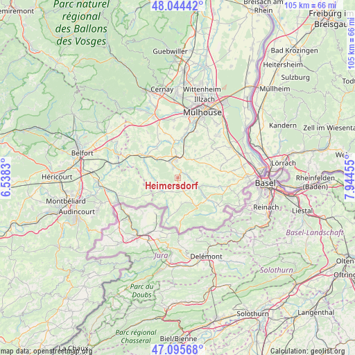
Heimersdorf GPS coordinates[2]
47° 34' 19.92" North, 7° 14' 29.112" East
| Map corner | latitude | longitude |
|---|---|---|
| Upper-left | 48.04442°, | 6.5383° |
| Center: | 47.5722°, | 7.24142° |
| Lower-right: | 47.09568°, | 7.94455° |
| Map W x H: | 105.5×105.5 km | = 65.6×65.6mi |
| max Lat: | 51.07786° ⇑47.7% North |
| Heimersdorf: | 47.5722° |
| min Lat: | ⇓52.3% South 41.3874° |
| min Long | Heimersdorf | max Long |
| -5.08615° | 7.24142° | 9.52242° |
| W 96.1%⇐ | ⇒3.9% E |
Elevation
Elevation of Heimersdorf is 356 m = 1168 ft, and this is 162.3 m = 532 ft above average elevation for this country.
| Max E: |
2333 m = 7654 ft | 14.3% |
| Heimersdorf | 356 m 1168 ft | |
| Avg. | 193.7 m = 635 ft | |
Min E: |
-1 m = -3 ft | 85.7% |
See also: France elevation on elevation.city.
Geographical zone
Heimersdorf is located in North temperate zone (between Tropic of Cancer and the Arctic Circle). Distance of this North polar circle is 2111.6 km =1312.1 mi to North.| Distance of | km | miles | from Heimersdorf |
|---|---|---|---|
| North Pole | 4717.5 | 2931.3 | to North |
| Arctic Circle | 2111.6 | 1312.1 | to North |
| Tropic Cancer | 2683.6 | 1667.5 | to South |
| Equator | 5289.5 | 3286.7 | to South |


Nearby cities:
15 places around Heimersdorf: (largest is in red/bold)
• Altkirch
5.8 km =3.6 mi,  358°
358°
• Aspach
7.8 km =4.8 mi, 355°
• Bisel
4.5 km =2.8 mi,  202°
202°
• Carspach
5.4 km =3.4 mi,  334°
334°
• Friesen
6.9 km =4.3 mi,  263°
263°
• Grentzingen
4.4 km =2.7 mi,  101°
101°
• Hirsingue
1.9 km =1.2 mi,  26°
26°
• Hirtzbach
3.2 km =2 mi, 333°
• Oberdorf
5 km =3.1 mi,  106°
106°
• Riespach
5 km =3.1 mi,  136°
136°
• Roppentzwiller
7.6 km =4.7 mi,  117°
117°
• Seppois-le-Bas
6.4 km =4 mi,  233°
233°
• Steinsoultz
7.5 km =4.7 mi, 107°
• Waldighofen
6 km =3.7 mi, 113°
• Wittersdorf
6.1 km =3.8 mi,  24°
24°
Sources, notices
• [Note1] Compared only with cities in France existing in our database
• [Src1] Map data: © OpenStreetMap contributors (CC-BY-SA)
• [Src2] Other city data from geonames.org with taken over terms of usage.
• [Src3] Geographical zone / Annual Mean Temperature by Robert A. Rohde @ Wikipedia
