Dannemarie geodata
Dannemarie (Grand Est) is a populated place; located in France in Europe/Paris (GMT+2) time zone. With population of 2,078 people, there are 4627 cities with bigger population in this country. Compared to other cities in France, 53.1% of cities are located further ↓South; 95.4% of cities are located further ←West and 82.4% of cities have lower elevation than Dannemarie. Note1
Administrative division(s):
- Level 1: Grand Est
- Level 2: Haut-Rhin
- Level 3: Altkirch
- Level 4: Dannemarie


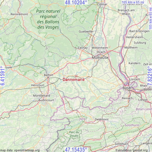
Dannemarie GPS coordinates[2]
47° 37' 49.224" North, 7° 7' 8.508" East
| Map corner | latitude | longitude |
|---|---|---|
| Upper-left | 48.10204°, | 6.41591° |
| Center: | 47.63034°, | 7.11903° |
| Lower-right: | 47.15435°, | 7.82216° |
| Map W x H: | 105.4×105.4 km | = 65.5×65.5mi |
| max Lat: | 51.07786° ⇑46.9% North |
| Dannemarie: | 47.63034° |
| min Lat: | ⇓53.1% South 41.3874° |
| min Long | Dannemarie | max Long |
| -5.08615° | 7.11903° | 9.52242° |
| W 95.4%⇐ | ⇒4.6% E |
Elevation
Elevation of Dannemarie is 315 m = 1033 ft, and this is 121.3 m = 398 ft above average elevation for this country.
| Max E: |
2333 m = 7654 ft | 17.6% |
| Dannemarie | 315 m 1033 ft | |
| Avg. | 193.7 m = 635 ft | |
Min E: |
-1 m = -3 ft | 82.4% |
See also: France elevation on elevation.city.
Geographical zone
Dannemarie is located in North temperate zone (between Tropic of Cancer and the Arctic Circle). Distance of this North polar circle is 2105.2 km =1308.1 mi to North.| Distance of | km | miles | from Dannemarie |
|---|---|---|---|
| North Pole | 4711.1 | 2927.3 | to North |
| Arctic Circle | 2105.2 | 1308.1 | to North |
| Tropic Cancer | 2690.1 | 1671.6 | to South |
| Equator | 5296 | 3290.8 | to South |


Nearby cities:
15 places around Dannemarie: (largest is in red/bold)
• Altkirch
9.1 km =5.7 mi,  94°
94°
• Aspach
8.7 km =5.4 mi,  81°
81°
• Ballersdorf
3.2 km =2 mi,  102°
102°
• Balschwiller
5.9 km =3.7 mi,  39°
39°
• Bernwiller
8.6 km =5.3 mi, 37°
• Carspach
7 km =4.3 mi, 103°
• Foussemagne
8.6 km =5.3 mi,  274°
274°
• Friesen
7.7 km =4.8 mi,  161°
161°
• Hagenbach
3.6 km =2.2 mi,  54°
54°
• Hirtzbach
8.5 km =5.3 mi,  114°
114°
• Manspach
1.7 km =1.1 mi,  217°
217°
• Montreux-Vieux
7.4 km =4.6 mi,  259°
259°
• Retzwiller
1.9 km =1.2 mi,  275°
275°
• Spechbach-le-Bas
9.2 km =5.7 mi,  61°
61°
• Spechbach-le-Haut
9.2 km =5.7 mi, 51°
Sources, notices
• [Note1] Compared only with cities in France existing in our database
• [Src1] Map data: © OpenStreetMap contributors (CC-BY-SA)
• [Src2] Other city data from geonames.org with taken over terms of usage.
• [Src3] Geographical zone / Annual Mean Temperature by Robert A. Rohde @ Wikipedia
