Friesen geodata
Friesen (Grand Est) is a populated place; located in France in Europe/Paris (GMT+2) time zone. With population of 543 people, there are 14333 cities with bigger population in this country. Compared to other cities in France, 52.2% of cities are located further ↓South; 95.5% of cities are located further ←West and 86% of cities have lower elevation than Friesen. Note1
Administrative division(s):
- Level 1: Grand Est
- Level 2: Haut-Rhin
- Level 3: Altkirch
- Level 4: Friesen


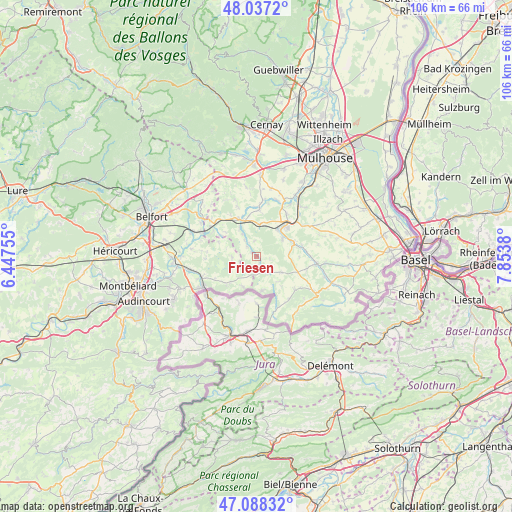
Friesen GPS coordinates[2]
47° 33' 53.676" North, 7° 9' 2.448" East
| Map corner | latitude | longitude |
|---|---|---|
| Upper-left | 48.0372°, | 6.44755° |
| Center: | 47.56491°, | 7.15068° |
| Lower-right: | 47.08832°, | 7.8538° |
| Map W x H: | 105.5×105.5 km | = 65.6×65.6mi |
| max Lat: | 51.07786° ⇑47.8% North |
| Friesen: | 47.56491° |
| min Lat: | ⇓52.2% South 41.3874° |
| min Long | Friesen | max Long |
| -5.08615° | 7.15068° | 9.52242° |
| W 95.5%⇐ | ⇒4.5% E |
Elevation
Elevation of Friesen is 360 m = 1181 ft, and this is 166.3 m = 546 ft above average elevation for this country.
| Max E: |
2333 m = 7654 ft | 14% |
| Friesen | 360 m 1181 ft | |
| Avg. | 193.7 m = 635 ft | |
Min E: |
-1 m = -3 ft | 86% |
See also: France elevation on elevation.city.
Geographical zone
Friesen is located in North temperate zone (between Tropic of Cancer and the Arctic Circle). Distance of this North polar circle is 2112.5 km =1312.6 mi to North.| Distance of | km | miles | from Friesen |
|---|---|---|---|
| North Pole | 4718.3 | 2931.8 | to North |
| Arctic Circle | 2112.5 | 1312.6 | to North |
| Tropic Cancer | 2682.8 | 1667 | to South |
| Equator | 5288.7 | 3286.2 | to South |


Nearby cities:
15 places around Friesen: (largest is in red/bold)
• Altkirch
9.4 km =5.8 mi,  45°
45°
• Ballersdorf
6.6 km =4.1 mi,  6°
6°
• Bisel
6.1 km =3.8 mi,  123°
123°
• Carspach
7.2 km =4.5 mi,  38°
38°
• Dannemarie
7.7 km =4.8 mi,  341°
341°
• Hagenbach
9.4 km =5.8 mi,  3°
3°
• Heimersdorf
6.9 km =4.3 mi,  83°
83°
• Hirsingue
8.1 km =5 mi,  71°
71°
• Hirtzbach
6.5 km =4 mi,  55°
55°
• Manspach
6.8 km =4.2 mi,  329°
329°
• Mœrnach
10.4 km =6.5 mi,  134°
134°
• Pfetterhouse
7.2 km =4.5 mi,  170°
170°
• Retzwiller
8.6 km =5.3 mi, 330°
• Réchésy
6.9 km =4.3 mi,  204°
204°
• Seppois-le-Bas
3.5 km =2.2 mi,  150°
150°
Sources, notices
• [Note1] Compared only with cities in France existing in our database
• [Src1] Map data: © OpenStreetMap contributors (CC-BY-SA)
• [Src2] Other city data from geonames.org with taken over terms of usage.
• [Src3] Geographical zone / Annual Mean Temperature by Robert A. Rohde @ Wikipedia
