Rainneville geodata
Rainneville (Hauts-de-France) is a populated place; located in France in Europe/Paris (GMT+2) time zone. With population of 777 people, there are 10851 cities with bigger population in this country. Compared to other cities in France, 93.4% of cities are located further ↓South; 51.7% of cities are located further →East and 52% of cities have higher elevation than Rainneville. Note1
Administrative division(s):
- Level 1: Hauts-de-France
- Level 2: Somme
- Level 3: Amiens
- Level 4: Rainneville


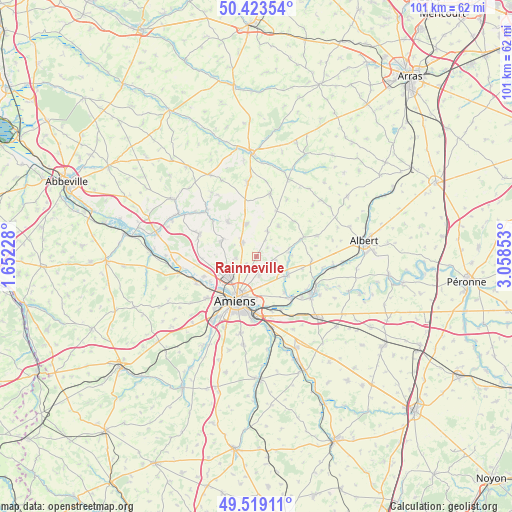
Rainneville GPS coordinates[2]
49° 58' 24.42" North, 2° 21' 19.476" East
| Map corner | latitude | longitude |
|---|---|---|
| Upper-left | 50.42354°, | 1.65228° |
| Center: | 49.97345°, | 2.35541° |
| Lower-right: | 49.51911°, | 3.05853° |
| Map W x H: | 100.6×100.6 km | = 62.5×62.5mi |
| max Lat: | 51.07786° ⇑6.6% North |
| Rainneville: | 49.97345° |
| min Lat: | ⇓93.4% South 41.3874° |
| min Long | Rainneville | max Long |
| -5.08615° | 2.35541° | 9.52242° |
| W 48.3%⇐ | ⇒51.7% E |
Elevation
Elevation of Rainneville is 125 m = 410 ft, and this is 68.7 m = 225 ft below average elevation for this country.
| Max E: |
2333 m = 7654 ft | 52% |
| Avg. | 193.7 m = 635 ft | |
| Rainneville | 125 m = 410 ft | |
Min E: |
-1 m = -3 ft | 48% |
See also: France elevation on elevation.city.
Geographical zone
Rainneville is located in North temperate zone (between Tropic of Cancer and the Arctic Circle). Distance of this North polar circle is 1844.6 km =1146.2 mi to North.| Distance of | km | miles | from Rainneville |
|---|---|---|---|
| North Pole | 4450.5 | 2765.4 | to North |
| Arctic Circle | 1844.6 | 1146.2 | to North |
| Tropic Cancer | 2950.6 | 1833.4 | to South |
| Equator | 5556.5 | 3452.6 | to South |


Nearby cities:
15 places around Rainneville: (largest is in red/bold)
• Allonville
3.7 km =2.3 mi,  171°
171°
• Amiens
9.1 km =5.7 mi,  205°
205°
• Bertangles
4.1 km =2.5 mi,  264°
264°
• Camon
9.6 km =6 mi,  184°
184°
• Daours
10 km =6.2 mi,  140°
140°
• Flesselles
7.4 km =4.6 mi,  295°
295°
• Hérissart
7.4 km =4.6 mi,  36°
36°
• Naours
9 km =5.6 mi,  321°
321°
• Pont-Noyelles
7.3 km =4.5 mi,  119°
119°
• Poulainville
4.2 km =2.6 mi,  225°
225°
• Querrieu
6.6 km =4.1 mi,  125°
125°
• Rivery
8.2 km =5.1 mi,  196°
196°
• Rubempré
5.5 km =3.4 mi,  23°
23°
• Talmas
6.7 km =4.2 mi,  341°
341°
• Villers-Bocage
3.9 km =2.4 mi,  314°
314°
Sources, notices
• [Note1] Compared only with cities in France existing in our database
• [Src1] Map data: © OpenStreetMap contributors (CC-BY-SA)
• [Src2] Other city data from geonames.org with taken over terms of usage.
• [Src3] Geographical zone / Annual Mean Temperature by Robert A. Rohde @ Wikipedia
