Talmas geodata
Talmas (Hauts-de-France) is a populated place; located in France in Europe/Paris (GMT+2) time zone. With population of 1,068 people, there are 8349 cities with bigger population in this country. Compared to other cities in France, 93.8% of cities are located further ↓South; 52.3% of cities are located further →East and 51.1% of cities have lower elevation than Talmas. Note1


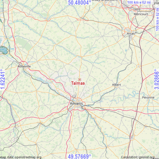
Talmas GPS coordinates[2]
50° 1' 49.764" North, 2° 19' 31.944" East
| Map corner | latitude | longitude |
|---|---|---|
| Upper-left | 50.48004°, | 1.62241° |
| Center: | 50.03049°, | 2.32554° |
| Lower-right: | 49.57669°, | 3.02866° |
| Map W x H: | 100.4×100.4 km | = 62.4×62.4mi |
| max Lat: | 51.07786° ⇑6.2% North |
| Talmas: | 50.03049° |
| min Lat: | ⇓93.8% South 41.3874° |
| min Long | Talmas | max Long |
| -5.08615° | 2.32554° | 9.52242° |
| W 47.7%⇐ | ⇒52.3% E |
Elevation
Elevation of Talmas is 136 m = 446 ft, and this is 57.7 m = 189 ft below average elevation for this country.
| Max E: |
2333 m = 7654 ft | 48.9% |
| Avg. | 193.7 m = 635 ft | |
| Talmas | 136 m = 446 ft | |
Min E: |
-1 m = -3 ft | 51.1% |
See also: France elevation on elevation.city.
Geographical zone
Talmas is located in North temperate zone (between Tropic of Cancer and the Arctic Circle). Distance of this North polar circle is 1838.3 km =1142.3 mi to North.| Distance of | km | miles | from Talmas |
|---|---|---|---|
| North Pole | 4444.2 | 2761.5 | to North |
| Arctic Circle | 1838.3 | 1142.3 | to North |
| Tropic Cancer | 2957 | 1837.4 | to South |
| Equator | 5562.9 | 3456.6 | to South |


Nearby cities:
15 places around Talmas: (largest is in red/bold)
• Allonville
10.4 km =6.5 mi,  164°
164°
• Beauquesne
7.8 km =4.8 mi,  38°
38°
• Beauval
8.6 km =5.3 mi,  3°
3°
• Bertangles
7 km =4.3 mi,  195°
195°
• Canaples
8.1 km =5 mi,  290°
290°
• Candas
9.7 km =6 mi,  331°
331°
• Flesselles
5.6 km =3.5 mi,  235°
235°
• Hérissart
6.5 km =4 mi,  93°
93°
• Naours
3.5 km =2.2 mi,  281°
281°
• Pernois
10.2 km =6.3 mi, 284°
• Poulainville
9.3 km =5.8 mi,  185°
185°
• Rainneville
6.7 km =4.2 mi, 161°
• Rubempré
4.5 km =2.8 mi,  107°
107°
• Vignacourt
9.4 km =5.8 mi,  257°
257°
• Villers-Bocage
3.7 km =2.3 mi, 189°
Sources, notices
• [Note1] Compared only with cities in France existing in our database
• [Src1] Map data: © OpenStreetMap contributors (CC-BY-SA)
• [Src2] Other city data from geonames.org with taken over terms of usage.
• [Src3] Geographical zone / Annual Mean Temperature by Robert A. Rohde @ Wikipedia
