Allonville geodata
Allonville (Hauts-de-France) is a populated place; located in France in Europe/Paris (GMT+2) time zone. With population of 582 people, there are 13612 cities with bigger population in this country. Compared to other cities in France, 93.2% of cities are located further ↓South; 51.6% of cities are located further →East and 59.1% of cities have higher elevation than Allonville. Note1
Administrative division(s):
- Level 1: Hauts-de-France
- Level 2: Somme
- Level 3: Amiens
- Level 4: Allonville


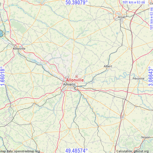
Allonville GPS coordinates[2]
49° 56' 25.404" North, 2° 21' 47.88" East
| Map corner | latitude | longitude |
|---|---|---|
| Upper-left | 50.39079°, | 1.66018° |
| Center: | 49.94039°, | 2.3633° |
| Lower-right: | 49.48574°, | 3.06643° |
| Map W x H: | 100.6×100.6 km | = 62.5×62.5mi |
| max Lat: | 51.07786° ⇑6.8% North |
| Allonville: | 49.94039° |
| min Lat: | ⇓93.2% South 41.3874° |
| min Long | Allonville | max Long |
| -5.08615° | 2.3633° | 9.52242° |
| W 48.4%⇐ | ⇒51.6% E |
Elevation
Elevation of Allonville is 105 m = 344 ft, and this is 88.7 m = 291 ft below average elevation for this country.
| Max E: |
2333 m = 7654 ft | 59.1% |
| Avg. | 193.7 m = 635 ft | |
| Allonville | 105 m = 344 ft | |
Min E: |
-1 m = -3 ft | 40.9% |
See also: France elevation on elevation.city.
Geographical zone
Allonville is located in North temperate zone (between Tropic of Cancer and the Arctic Circle). Distance of this North polar circle is 1848.3 km =1148.5 mi to North.| Distance of | km | miles | from Allonville |
|---|---|---|---|
| North Pole | 4454.2 | 2767.7 | to North |
| Arctic Circle | 1848.3 | 1148.5 | to North |
| Tropic Cancer | 2946.9 | 1831.1 | to South |
| Equator | 5552.9 | 3450.4 | to South |


Nearby cities:
15 places around Allonville: (largest is in red/bold)
• Amiens
6.4 km =4 mi,  225°
225°
• Bertangles
5.7 km =3.5 mi,  305°
305°
• Blangy-Tronville
8 km =5 mi,  148°
148°
• Camon
6 km =3.7 mi,  192°
192°
• Daours
7.1 km =4.4 mi,  125°
125°
• Glisy
7.4 km =4.6 mi,  160°
160°
• Longueau
7.6 km =4.7 mi,  182°
182°
• Pont-Noyelles
5.8 km =3.6 mi,  89°
89°
• Poulainville
3.6 km =2.2 mi,  282°
282°
• Querrieu
4.8 km =3 mi, 92°
• Rainneville
3.7 km =2.3 mi,  351°
351°
• Rivery
5.1 km =3.2 mi,  215°
215°
• Rubempré
8.8 km =5.5 mi,  10°
10°
• Vecquemont
7.7 km =4.8 mi, 125°
• Villers-Bocage
7.2 km =4.5 mi,  332°
332°
Sources, notices
• [Note1] Compared only with cities in France existing in our database
• [Src1] Map data: © OpenStreetMap contributors (CC-BY-SA)
• [Src2] Other city data from geonames.org with taken over terms of usage.
• [Src3] Geographical zone / Annual Mean Temperature by Robert A. Rohde @ Wikipedia
