Rablay-sur-Layon geodata
Rablay-sur-Layon (Pays de la Loire) is a populated place; located in France in Europe/Paris (GMT+2) time zone. With population of 679 people, there are 12079 cities with bigger population in this country. Compared to other cities in France, 51.6% of cities are located further ↑North; 84.2% of cities are located further →East and 84.1% of cities have higher elevation than Rablay-sur-Layon. Note1
Administrative division(s):
- Level 1: Pays de la Loire
- Level 2: Département de Maine-et-Loire
- Level 3: Angers
- Level 4: Bellevigne-en-Layon


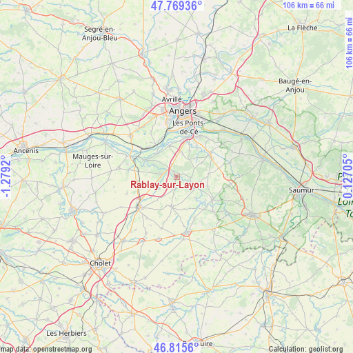
Rablay-sur-Layon GPS coordinates[2]
47° 17' 40.668" North, 0° 34' 33.888" West
| Map corner | latitude | longitude |
|---|---|---|
| Upper-left | 47.76936°, | -1.2792° |
| Center: | 47.29463°, | -0.57608° |
| Lower-right: | 46.8156°, | 0.12705° |
| Map W x H: | 106×106 km | = 65.9×65.9mi |
| max Lat: | 51.07786° ⇑51.6% North |
| Rablay-sur-Layon: | 47.29463° |
| min Lat: | ⇓48.4% South 41.3874° |
| min Long | Rablay-sur-Layo | max Long |
| -5.08615° | -0.57608° | 9.52242° |
| W 15.8%⇐ | ⇒84.2% E |
Elevation
Elevation of Rablay-sur-Layon is 44 m = 144 ft, and this is 149.7 m = 491 ft below average elevation for this country.
| Max E: |
2333 m = 7654 ft | 84.1% |
| Avg. | 193.7 m = 635 ft | |
| Rablay-sur-Layon | 44 m = 144 ft | |
Min E: |
-1 m = -3 ft | 15.9% |
See also: France elevation on elevation.city.
Geographical zone
Rablay-sur-Layon is located in North temperate zone (between Tropic of Cancer and the Arctic Circle). Distance of this North polar circle is 2142.5 km =1331.3 mi to North.| Distance of | km | miles | from Rablay-sur-Layon |
|---|---|---|---|
| North Pole | 4748.4 | 2950.5 | to North |
| Arctic Circle | 2142.5 | 1331.3 | to North |
| Tropic Cancer | 2652.8 | 1648.4 | to South |
| Equator | 5258.7 | 3267.6 | to South |


Nearby cities:
15 places around Rablay-sur-Layon: (largest is in red/bold)
• Beaulieu-sur-Layon
2.1 km =1.3 mi,  330°
330°
• Chanzeaux
6.2 km =3.9 mi,  235°
235°
• Chaudefonds-sur-Layon
10.4 km =6.5 mi,  289°
289°
• Chavagnes
9.5 km =5.9 mi,  106°
106°
• Denée
9.7 km =6 mi,  345°
345°
• Faveraye-Mâchelles
7.6 km =4.7 mi,  130°
130°
• Mozé-sur-Louet
7.3 km =4.5 mi,  13°
13°
• Rochefort-sur-Loire
9.2 km =5.7 mi,  318°
318°
• Saint-Aubin-de-Luigné
7.6 km =4.7 mi,  297°
297°
• Saint-Lambert-du-Lattay
4.4 km =2.7 mi,  281°
281°
• Saint-Melaine-sur-Aubance
9.9 km =6.2 mi,  35°
35°
• Savennières
11.5 km =7.1 mi, 327°
• Soulaines-sur-Aubance
8.7 km =5.4 mi,  27°
27°
• Thouarcé
6.4 km =4 mi,  118°
118°
• Vauchrétien
8.6 km =5.3 mi,  60°
60°
Sources, notices
• [Note1] Compared only with cities in France existing in our database
• [Src1] Map data: © OpenStreetMap contributors (CC-BY-SA)
• [Src2] Other city data from geonames.org with taken over terms of usage.
• [Src3] Geographical zone / Annual Mean Temperature by Robert A. Rohde @ Wikipedia
