Saint-Lambert-du-Lattay geodata
Saint-Lambert-du-Lattay (Pays de la Loire) is a populated place; located in France in Europe/Paris (GMT+2) time zone. With population of 1,550 people, there are 6010 cities with bigger population in this country. Compared to other cities in France, 51.5% of cities are located further ↑North; 84.8% of cities are located further →East and 77% of cities have higher elevation than Saint-Lambert-du-Lattay. Note1
Administrative division(s):
- Level 1: Pays de la Loire
- Level 2: Département de Maine-et-Loire
- Level 3: Angers
- Level 4: Val-du-Layon
Current local time in Saint-Lambert-du-Lattay:
09:57 AM, SaturdayDifference from your time zone: hours


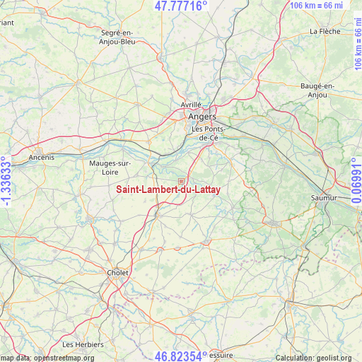
Saint-Lambert-du-Lattay GPS coordinates[2]
47° 18' 9" North, 0° 37' 59.556" West
| Map corner | latitude | longitude |
|---|---|---|
| Upper-left | 47.77716°, | -1.33633° |
| Center: | 47.3025°, | -0.63321° |
| Lower-right: | 46.82354°, | 0.06991° |
| Map W x H: | 106×106 km | = 65.9×65.9mi |
| max Lat: | 51.07786° ⇑51.5% North |
| Saint-Lambert-du-Lattay: | 47.3025° |
| min Lat: | ⇓48.5% South 41.3874° |
| min Long | Saint-Lambert-d | max Long |
| -5.08615° | -0.63321° | 9.52242° |
| W 15.2%⇐ | ⇒84.8% E |
Elevation
Elevation of Saint-Lambert-du-Lattay is 62 m = 203 ft, and this is 131.7 m = 432 ft below average elevation for this country.
| Max E: |
2333 m = 7654 ft | 77% |
| Avg. | 193.7 m = 635 ft | |
| Saint-Lambert-du-Lattay | 62 m = 203 ft | |
Min E: |
-1 m = -3 ft | 23% |
See also: France elevation on elevation.city.
Geographical zone
Saint-Lambert-du-Lattay is located in North temperate zone (between Tropic of Cancer and the Arctic Circle). Distance of this North polar circle is 2141.6 km =1330.7 mi to North.| Distance of | km | miles | from Saint-Lambert-du-Lattay |
|---|---|---|---|
| North Pole | 4747.5 | 2950 | to North |
| Arctic Circle | 2141.6 | 1330.7 | to North |
| Tropic Cancer | 2653.6 | 1648.9 | to South |
| Equator | 5259.5 | 3268.1 | to South |


Nearby cities:
15 places around Saint-Lambert-du-Lattay: (largest is in red/bold)
• Beaulieu-sur-Layon
3.4 km =2.1 mi,  73°
73°
• Chalonnes-sur-Loire
11.2 km =7 mi,  299°
299°
• Chanzeaux
4.4 km =2.7 mi,  189°
189°
• Chaudefonds-sur-Layon
6.1 km =3.8 mi,  294°
294°
• Denée
8.7 km =5.4 mi,  12°
12°
• Faveraye-Mâchelles
11.6 km =7.2 mi,  120°
120°
• La Jumellière
7.7 km =4.8 mi,  250°
250°
• La Possonnière
9 km =5.6 mi,  333°
333°
• Mozé-sur-Louet
8.7 km =5.4 mi,  44°
44°
• Rablay-sur-Layon
4.4 km =2.7 mi,  101°
101°
• Rochefort-sur-Loire
6.3 km =3.9 mi,  343°
343°
• Saint-Aubin-de-Luigné
3.6 km =2.2 mi,  318°
318°
• Savennières
9 km =5.6 mi,  348°
348°
• Soulaines-sur-Aubance
10.8 km =6.7 mi,  50°
50°
• Thouarcé
10.7 km =6.6 mi,  111°
111°
Sources, notices
• [Note1] Compared only with cities in France existing in our database
• [Src1] Map data: © OpenStreetMap contributors (CC-BY-SA)
• [Src2] Other city data from geonames.org with taken over terms of usage.
• [Src3] Geographical zone / Annual Mean Temperature by Robert A. Rohde @ Wikipedia
