Chaudefonds-sur-Layon geodata
Chaudefonds-sur-Layon (Pays de la Loire) is a populated place; located in France in Europe/Paris (GMT+2) time zone. With population of 834 people, there are 10255 cities with bigger population in this country. Compared to other cities in France, 51.1% of cities are located further ↑North; 85.6% of cities are located further →East and 95% of cities have higher elevation than Chaudefonds-sur-Layon. Note1
Administrative division(s):
- Level 1: Pays de la Loire
- Level 2: Département de Maine-et-Loire
- Level 3: Angers
- Level 4: Chaudefonds-sur-Layon
Current local time in Chaudefonds-sur-Layon:
09:58 AM, SaturdayDifference from your time zone: hours


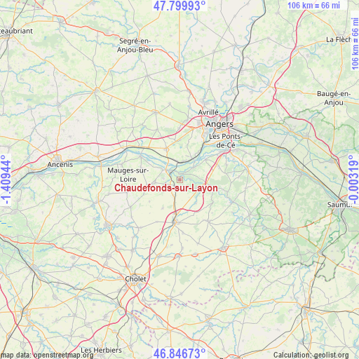
Chaudefonds-sur-Layon GPS coordinates[2]
47° 19' 31.728" North, 0° 42' 22.716" West
| Map corner | latitude | longitude |
|---|---|---|
| Upper-left | 47.79993°, | -1.40944° |
| Center: | 47.32548°, | -0.70631° |
| Lower-right: | 46.84673°, | -0.00319° |
| Map W x H: | 106×106 km | = 65.9×65.9mi |
| max Lat: | 51.07786° ⇑51.1% North |
| Chaudefonds-sur-Layon: | 47.32548° |
| min Lat: | ⇓48.9% South 41.3874° |
| min Long | Chaudefonds-sur | max Long |
| -5.08615° | -0.70631° | 9.52242° |
| W 14.4%⇐ | ⇒85.6% E |
Elevation
Elevation of Chaudefonds-sur-Layon is 17 m = 56 ft, and this is 176.7 m = 580 ft below average elevation for this country.
| Max E: |
2333 m = 7654 ft | 95% |
| Avg. | 193.7 m = 635 ft | |
| Chaudefonds-sur-Layon | 17 m = 56 ft | |
Min E: |
-1 m = -3 ft | 5% |
See also: France elevation on elevation.city.
Geographical zone
Chaudefonds-sur-Layon is located in North temperate zone (between Tropic of Cancer and the Arctic Circle). Distance of this North polar circle is 2139.1 km =1329.2 mi to North.| Distance of | km | miles | from Chaudefonds-sur-Layon |
|---|---|---|---|
| North Pole | 4745 | 2948.4 | to North |
| Arctic Circle | 2139.1 | 1329.2 | to North |
| Tropic Cancer | 2656.2 | 1650.5 | to South |
| Equator | 5262.1 | 3269.7 | to South |


Nearby cities:
15 places around Chaudefonds-sur-Layon: (largest is in red/bold)
• Beaulieu-sur-Layon
8.9 km =5.5 mi,  100°
100°
• Bourgneuf-en-Mauges
9.8 km =6.1 mi,  261°
261°
• Chalonnes-sur-Loire
5.2 km =3.2 mi,  304°
304°
• Chanzeaux
8.4 km =5.2 mi,  145°
145°
• Denée
9.5 km =5.9 mi,  51°
51°
• La Jumellière
5.4 km =3.4 mi,  198°
198°
• La Possonnière
5.7 km =3.5 mi,  16°
16°
• Rablay-sur-Layon
10.4 km =6.5 mi,  109°
109°
• Rochefort-sur-Loire
5.1 km =3.2 mi, 46°
• Saint-Aubin-de-Luigné
3.1 km =1.9 mi,  87°
87°
• Saint-Georges-sur-Loire
10.1 km =6.3 mi,  335°
335°
• Saint-Lambert-du-Lattay
6.1 km =3.8 mi, 114°
• Saint-Laurent-de-la-Plaine
7.4 km =4.6 mi, 262°
• Saint-Lézin
9.8 km =6.1 mi,  211°
211°
• Savennières
7.3 km =4.5 mi,  30°
30°
Sources, notices
• [Note1] Compared only with cities in France existing in our database
• [Src1] Map data: © OpenStreetMap contributors (CC-BY-SA)
• [Src2] Other city data from geonames.org with taken over terms of usage.
• [Src3] Geographical zone / Annual Mean Temperature by Robert A. Rohde @ Wikipedia
