Pinel-Hauterive geodata
Pinel-Hauterive (Nouvelle-Aquitaine) is a populated place; located in France in Europe/Paris (GMT+2) time zone. With population of 502 people, there are 15200 cities with bigger population in this country. Compared to other cities in France, 84% of cities are located further ↑North; 72.6% of cities are located further →East and 76.6% of cities have higher elevation than Pinel-Hauterive. Note1
Administrative division(s):
- Level 1: Nouvelle-Aquitaine
- Level 2: Département du Lot-et-Garonne
- Level 3: Arrondissement de Villeneuve-sur-Lot
- Level 4: Pinel-Hauterive


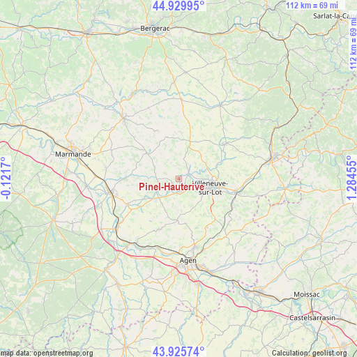
Pinel-Hauterive GPS coordinates[2]
44° 25' 48" North, 0° 34' 53.112" East
| Map corner | latitude | longitude |
|---|---|---|
| Upper-left | 44.92995°, | -0.1217° |
| Center: | 44.43°, | 0.58142° |
| Lower-right: | 43.92574°, | 1.28455° |
| Map W x H: | 111.7×111.7 km | = 69.4×69.4mi |
| max Lat: | 51.07786° ⇑84% North |
| Pinel-Hauterive: | 44.43° |
| min Lat: | ⇓16% South 41.3874° |
| min Long | Pinel-Hauterive | max Long |
| -5.08615° | 0.58142° | 9.52242° |
| W 27.4%⇐ | ⇒72.6% E |
Elevation
Elevation of Pinel-Hauterive is 63 m = 207 ft, and this is 130.7 m = 429 ft below average elevation for this country.
| Max E: |
2333 m = 7654 ft | 76.6% |
| Avg. | 193.7 m = 635 ft | |
| Pinel-Hauterive | 63 m = 207 ft | |
Min E: |
-1 m = -3 ft | 23.4% |
See also: France elevation on elevation.city.
Geographical zone
Pinel-Hauterive is located in North temperate zone (between Tropic of Cancer and the Arctic Circle). Distance of this Northern Tropic circle is 2334.2 km =1450.4 mi to South.| Distance of | km | miles | from Pinel-Hauterive |
|---|---|---|---|
| North Pole | 5066.9 | 3148.4 | to North |
| Arctic Circle | 2461 | 1529.2 | to North |
| Tropic Cancer | 2334.2 | 1450.4 | to South |
| Equator | 4940.2 | 3069.7 | to South |


Nearby cities:
15 places around Pinel-Hauterive: (largest is in red/bold)
• Allez-et-Cazeneuve
4.4 km =2.7 mi,  139°
139°
• Bias
7.2 km =4.5 mi,  102°
102°
• Casseneuil
3.5 km =2.2 mi,  65°
65°
• Castelmoron-sur-Lot
7.7 km =4.8 mi,  242°
242°
• Castelnaud-de-Gratecambe
10.1 km =6.3 mi,  42°
42°
• Dolmayrac
7.6 km =4.7 mi,  175°
175°
• Granges-sur-Lot
11 km =6.8 mi, 237°
• Le Temple-sur-Lot
7.2 km =4.5 mi,  218°
218°
• Lédat
7.5 km =4.7 mi, 70°
• Monclar
4.4 km =2.7 mi,  300°
300°
• Montpezat
10.2 km =6.3 mi,  206°
206°
• Pujols
9.4 km =5.8 mi,  115°
115°
• Saint-Étienne-de-Fougères
2.4 km =1.5 mi, 238°
• Sainte-Livrade-sur-Lot
3.5 km =2.2 mi,  167°
167°
• Villeneuve-sur-Lot
10 km =6.2 mi, 103°
Sources, notices
• [Note1] Compared only with cities in France existing in our database
• [Src1] Map data: © OpenStreetMap contributors (CC-BY-SA)
• [Src2] Other city data from geonames.org with taken over terms of usage.
• [Src3] Geographical zone / Annual Mean Temperature by Robert A. Rohde @ Wikipedia
