Pujaudran geodata
Pujaudran (Occitanie) is a populated place; located in France in Europe/Paris (GMT+2) time zone. With population of 1,218 people, there are 7443 cities with bigger population in this country. Compared to other cities in France, 92% of cities are located further ↑North; 67.3% of cities are located further →East and 79.6% of cities have lower elevation than Pujaudran. Note1


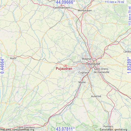
Pujaudran GPS coordinates[2]
43° 35' 22.344" North, 1° 8' 59.172" East
| Map corner | latitude | longitude |
|---|---|---|
| Upper-left | 44.09666°, | 0.44664° |
| Center: | 43.58954°, | 1.14977° |
| Lower-right: | 43.07811°, | 1.85289° |
| Map W x H: | 113.3×113.3 km | = 70.4×70.4mi |
| max Lat: | 51.07786° ⇑92% North |
| Pujaudran: | 43.58954° |
| min Lat: | ⇓8% South 41.3874° |
| min Long | Pujaudran | max Long |
| -5.08615° | 1.14977° | 9.52242° |
| W 32.7%⇐ | ⇒67.3% E |
Elevation
Elevation of Pujaudran is 286 m = 938 ft, and this is 92.3 m = 303 ft above average elevation for this country.
| Max E: |
2333 m = 7654 ft | 20.4% |
| Pujaudran | 286 m 938 ft | |
| Avg. | 193.7 m = 635 ft | |
Min E: |
-1 m = -3 ft | 79.6% |
See also: France elevation on elevation.city.
Geographical zone
Pujaudran is located in North temperate zone (between Tropic of Cancer and the Arctic Circle). Distance of this Northern Tropic circle is 2240.8 km =1392.4 mi to South.| Distance of | km | miles | from Pujaudran |
|---|---|---|---|
| North Pole | 5160.4 | 3206.5 | to North |
| Arctic Circle | 2554.5 | 1587.3 | to North |
| Tropic Cancer | 2240.8 | 1392.4 | to South |
| Equator | 4846.7 | 3011.6 | to South |


Nearby cities:
15 places around Pujaudran: (largest is in red/bold)
• Auradé
7.9 km =4.9 mi,  250°
250°
• Bonrepos-sur-Aussonnelle
4.9 km =3 mi,  181°
181°
• Brax
7.9 km =4.9 mi,  66°
66°
• Fonsorbes
8.8 km =5.5 mi,  133°
133°
• Fontenilles
5.3 km =3.3 mi,  140°
140°
• La Salvetat-Saint-Gilles
9.9 km =6.2 mi,  98°
98°
• Lasserre
5.7 km =3.5 mi,  14°
14°
• Le Castéra
9.4 km =5.8 mi,  355°
355°
• Léguevin
6.8 km =4.2 mi,  79°
79°
• Lévignac
9.5 km =5.9 mi,  25°
25°
• L’Isle-Jourdain
6 km =3.7 mi,  294°
294°
• Saiguède
6.8 km =4.2 mi, 183°
• Saint-Lys
8.9 km =5.5 mi,  166°
166°
• Saint-Thomas
10 km =6.2 mi,  213°
213°
• Ségoufielle
4.9 km =3 mi,  342°
342°
Sources, notices
• [Note1] Compared only with cities in France existing in our database
• [Src1] Map data: © OpenStreetMap contributors (CC-BY-SA)
• [Src2] Other city data from geonames.org with taken over terms of usage.
• [Src3] Geographical zone / Annual Mean Temperature by Robert A. Rohde @ Wikipedia
