Léguevin geodata
Léguevin (Occitanie) is a populated place; located in France in Europe/Paris (GMT+2) time zone. With population of 6,976 people, there are 1411 cities with bigger population in this country. Compared to other cities in France, 91.8% of cities are located further ↑North; 66.3% of cities are located further →East and 65.2% of cities have lower elevation than Léguevin. Note1
Administrative division(s):
- Level 1: Occitanie
- Level 2: Haute-Garonne
- Level 3: Arrondissement de Toulouse
- Level 4: Léguevin


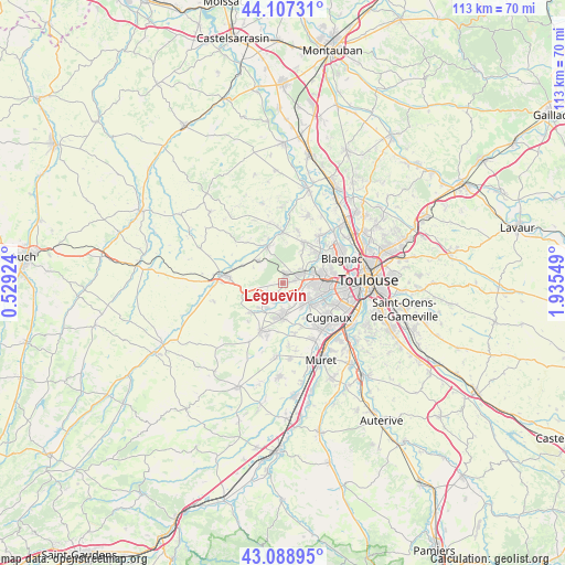
Léguevin GPS coordinates[2]
43° 36' 1.008" North, 1° 13' 56.496" East
| Map corner | latitude | longitude |
|---|---|---|
| Upper-left | 44.10731°, | 0.52924° |
| Center: | 43.60028°, | 1.23236° |
| Lower-right: | 43.08895°, | 1.93549° |
| Map W x H: | 113.2×113.2 km | = 70.3×70.3mi |
| max Lat: | 51.07786° ⇑91.8% North |
| Léguevin: | 43.60028° |
| min Lat: | ⇓8.2% South 41.3874° |
| min Long | Léguevin | max Long |
| -5.08615° | 1.23236° | 9.52242° |
| W 33.7%⇐ | ⇒66.3% E |
Elevation
Elevation of Léguevin is 195 m = 640 ft, and this is 1.3 m = 4 ft above average elevation for this country.
| Max E: |
2333 m = 7654 ft | 34.8% |
| Léguevin | 195 m 640 ft | |
| Avg. | 193.7 m = 635 ft | |
Min E: |
-1 m = -3 ft | 65.2% |
See also: France elevation on elevation.city.
Geographical zone
Léguevin is located in North temperate zone (between Tropic of Cancer and the Arctic Circle). Distance of this Northern Tropic circle is 2242 km =1393.1 mi to South.| Distance of | km | miles | from Léguevin |
|---|---|---|---|
| North Pole | 5159.2 | 3205.8 | to North |
| Arctic Circle | 2553.3 | 1586.5 | to North |
| Tropic Cancer | 2242 | 1393.1 | to South |
| Equator | 4847.9 | 3012.3 | to South |


Nearby cities:
15 places around Léguevin: (largest is in red/bold)
• Bonrepos-sur-Aussonnelle
9.1 km =5.7 mi,  228°
228°
• Brax
2 km =1.2 mi,  16°
16°
• Colomiers
8.3 km =5.2 mi,  82°
82°
• Cornebarrieu
9.2 km =5.7 mi,  53°
53°
• Fonsorbes
7.2 km =4.5 mi,  181°
181°
• Fontenilles
6.2 km =3.9 mi,  212°
212°
• La Salvetat-Saint-Gilles
4.2 km =2.6 mi,  130°
130°
• Lasserre
6.7 km =4.2 mi,  309°
309°
• Lévignac
7.8 km =4.8 mi,  340°
340°
• Mondonville
9.2 km =5.7 mi,  28°
28°
• Pibrac
4.8 km =3 mi,  62°
62°
• Plaisance-du-Touch
6.5 km =4 mi, 126°
• Pujaudran
6.8 km =4.2 mi,  259°
259°
• Ségoufielle
8.8 km =5.5 mi,  293°
293°
• Tournefeuille
7.1 km =4.4 mi,  100°
100°
Sources, notices
• [Note1] Compared only with cities in France existing in our database
• [Src1] Map data: © OpenStreetMap contributors (CC-BY-SA)
• [Src2] Other city data from geonames.org with taken over terms of usage.
• [Src3] Geographical zone / Annual Mean Temperature by Robert A. Rohde @ Wikipedia
