Prouzel geodata
Prouzel (Hauts-de-France) is a populated place; located in France in Europe/Paris (GMT+2) time zone. With population of 512 people, there are 14990 cities with bigger population in this country. Compared to other cities in France, 92.4% of cities are located further ↓South; 54.4% of cities are located further →East and 74.1% of cities have higher elevation than Prouzel. Note1
Administrative division(s):
- Level 1: Hauts-de-France
- Level 2: Somme
- Level 3: Amiens
- Level 4: Prouzel


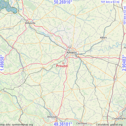
Prouzel GPS coordinates[2]
49° 49' 3.396" North, 2° 12' 6.156" East
| Map corner | latitude | longitude |
|---|---|---|
| Upper-left | 50.26916°, | 1.49858° |
| Center: | 49.81761°, | 2.20171° |
| Lower-right: | 49.36181°, | 2.90483° |
| Map W x H: | 100.9×100.9 km | = 62.7×62.7mi |
| max Lat: | 51.07786° ⇑7.6% North |
| Prouzel: | 49.81761° |
| min Lat: | ⇓92.4% South 41.3874° |
| min Long | Prouzel | max Long |
| -5.08615° | 2.20171° | 9.52242° |
| W 45.6%⇐ | ⇒54.4% E |
Elevation
Elevation of Prouzel is 69 m = 226 ft, and this is 124.7 m = 409 ft below average elevation for this country.
| Max E: |
2333 m = 7654 ft | 74.1% |
| Avg. | 193.7 m = 635 ft | |
| Prouzel | 69 m = 226 ft | |
Min E: |
-1 m = -3 ft | 25.9% |
See also: France elevation on elevation.city.
Geographical zone
Prouzel is located in North temperate zone (between Tropic of Cancer and the Arctic Circle). Distance of this North polar circle is 1862 km =1157 mi to North.| Distance of | km | miles | from Prouzel |
|---|---|---|---|
| North Pole | 4467.9 | 2776.2 | to North |
| Arctic Circle | 1862 | 1157 | to North |
| Tropic Cancer | 2933.3 | 1822.7 | to South |
| Equator | 5539.2 | 3441.9 | to South |


Nearby cities:
15 places around Prouzel: (largest is in red/bold)
• Bacouel-sur-Selle
2.2 km =1.4 mi,  50°
50°
• Dury
5.9 km =3.7 mi,  56°
56°
• Lœuilly
4.6 km =2.9 mi,  213°
213°
• Oresmaux
7.3 km =4.5 mi,  138°
138°
• Plachy-Buyon
1.2 km =0.7 mi,  106°
106°
• Pont-de-Metz
7.3 km =4.5 mi,  23°
23°
• Quevauvillers
8.4 km =5.2 mi,  274°
274°
• Revelles
6.7 km =4.2 mi,  301°
301°
• Rumigny
5.7 km =3.5 mi,  100°
100°
• Sains-en-Amiénois
8.4 km =5.2 mi,  90°
90°
• Saint-Fuscien
8.3 km =5.2 mi,  74°
74°
• Saint-Sauflieu
4.8 km =3 mi,  129°
129°
• Saleux
5 km =3.1 mi,  30°
30°
• Salouël
6.5 km =4 mi, 27°
• Vers-sur-Selles
2.9 km =1.8 mi, 52°
Sources, notices
• [Note1] Compared only with cities in France existing in our database
• [Src1] Map data: © OpenStreetMap contributors (CC-BY-SA)
• [Src2] Other city data from geonames.org with taken over terms of usage.
• [Src3] Geographical zone / Annual Mean Temperature by Robert A. Rohde @ Wikipedia
