Pré-en-Pail geodata
Pré-en-Pail (Pays de la Loire) is a populated place; located in France in Europe/Paris (GMT+2) time zone. With population of 2,129 people, there are 4517 cities with bigger population in this country. Compared to other cities in France, 67.5% of cities are located further ↓South; 79.6% of cities are located further →East and 71.8% of cities have lower elevation than Pré-en-Pail. Note1
Administrative division(s):
- Level 1: Pays de la Loire
- Level 2: Mayenne
- Level 3: Arrondissement de Mayenne
- Level 4: Pré-en-Pail-Saint-Samson


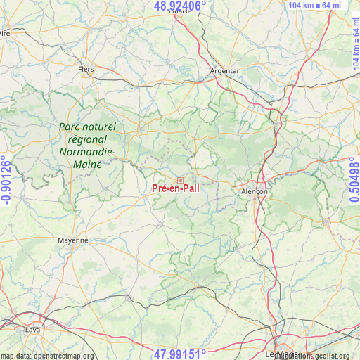
Pré-en-Pail GPS coordinates[2]
48° 27' 35.748" North, 0° 11' 53.304" West
| Map corner | latitude | longitude |
|---|---|---|
| Upper-left | 48.92406°, | -0.90126° |
| Center: | 48.45993°, | -0.19814° |
| Lower-right: | 47.99151°, | 0.50498° |
| Map W x H: | 103.7×103.7 km | = 64.4×64.4mi |
| max Lat: | 51.07786° ⇑32.5% North |
| Pré-en-Pail: | 48.45993° |
| min Lat: | ⇓67.5% South 41.3874° |
| min Long | Pré-en-Pail | max Long |
| -5.08615° | -0.19814° | 9.52242° |
| W 20.4%⇐ | ⇒79.6% E |
Elevation
Elevation of Pré-en-Pail is 229 m = 751 ft, and this is 35.3 m = 116 ft above average elevation for this country.
| Max E: |
2333 m = 7654 ft | 28.2% |
| Pré-en-Pail | 229 m 751 ft | |
| Avg. | 193.7 m = 635 ft | |
Min E: |
-1 m = -3 ft | 71.8% |
See also: France elevation on elevation.city.
Geographical zone
Pré-en-Pail is located in North temperate zone (between Tropic of Cancer and the Arctic Circle). Distance of this North polar circle is 2012.9 km =1250.8 mi to North.| Distance of | km | miles | from Pré-en-Pail |
|---|---|---|---|
| North Pole | 4618.8 | 2870 | to North |
| Arctic Circle | 2012.9 | 1250.8 | to North |
| Tropic Cancer | 2782.3 | 1728.8 | to South |
| Equator | 5388.2 | 3348.1 | to South |


Nearby cities:
15 places around Pré-en-Pail: (largest is in red/bold)
• Averton
14.4 km =8.9 mi,  187°
187°
• Carrouges
12.6 km =7.8 mi,  17°
17°
• Condé-sur-Sarthe
17.4 km =10.8 mi,  100°
100°
• Couterne
17.1 km =10.6 mi,  290°
290°
• Gesvres
10.9 km =6.8 mi,  159°
159°
• Javron-les-Chapelles
11.3 km =7 mi,  245°
245°
• La Ferrière-Bochard
13.2 km =8.2 mi,  113°
113°
• Lignières-Orgères
9.2 km =5.7 mi,  355°
355°
• Magny-le-Désert
15.5 km =9.6 mi,  322°
322°
• Mieuxcé
16.9 km =10.5 mi, 113°
• Moulins-le-Carbonnel
16 km =9.9 mi,  126°
126°
• Saint-Denis-sur-Sarthon
11.2 km =7 mi,  93°
93°
• Saint-Léonard-des-Bois
15 km =9.3 mi,  143°
143°
• Saint-Pierre-des-Nids
10 km =6.2 mi, 133°
• Villaines-la-Juhel
14.1 km =8.8 mi,  204°
204°
Sources, notices
• [Note1] Compared only with cities in France existing in our database
• [Src1] Map data: © OpenStreetMap contributors (CC-BY-SA)
• [Src2] Other city data from geonames.org with taken over terms of usage.
• [Src3] Geographical zone / Annual Mean Temperature by Robert A. Rohde @ Wikipedia
