Villaines-la-Juhel geodata
Villaines-la-Juhel (Pays de la Loire) is a populated place; located in France in Europe/Paris (GMT+2) time zone. With population of 3,320 people, there are 2940 cities with bigger population in this country. Compared to other cities in France, 65.4% of cities are located further ↓South; 80.6% of cities are located further →East and 63.1% of cities have lower elevation than Villaines-la-Juhel. Note1
Administrative division(s):
- Level 1: Pays de la Loire
- Level 2: Mayenne
- Level 3: Arrondissement de Mayenne
- Level 4: Villaines-la-Juhel


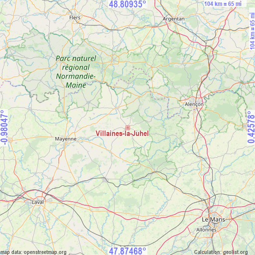
Villaines-la-Juhel GPS coordinates[2]
48° 20' 38.976" North, 0° 16' 38.424" West
| Map corner | latitude | longitude |
|---|---|---|
| Upper-left | 48.80935°, | -0.98047° |
| Center: | 48.34416°, | -0.27734° |
| Lower-right: | 47.87468°, | 0.42578° |
| Map W x H: | 103.9×103.9 km | = 64.6×64.6mi |
| max Lat: | 51.07786° ⇑34.6% North |
| Villaines-la-Juhel: | 48.34416° |
| min Lat: | ⇓65.4% South 41.3874° |
| min Long | Villaines-la-Ju | max Long |
| -5.08615° | -0.27734° | 9.52242° |
| W 19.4%⇐ | ⇒80.6% E |
Elevation
Elevation of Villaines-la-Juhel is 185 m = 607 ft, and this is 8.7 m = 29 ft below average elevation for this country.
| Max E: |
2333 m = 7654 ft | 36.9% |
| Avg. | 193.7 m = 635 ft | |
| Villaines-la-Juhel | 185 m = 607 ft | |
Min E: |
-1 m = -3 ft | 63.1% |
See also: France elevation on elevation.city.
Geographical zone
Villaines-la-Juhel is located in North temperate zone (between Tropic of Cancer and the Arctic Circle). Distance of this North polar circle is 2025.8 km =1258.8 mi to North.| Distance of | km | miles | from Villaines-la-Juhel |
|---|---|---|---|
| North Pole | 4631.7 | 2878 | to North |
| Arctic Circle | 2025.8 | 1258.8 | to North |
| Tropic Cancer | 2769.4 | 1720.8 | to South |
| Equator | 5375.4 | 3340.1 | to South |


Nearby cities:
15 places around Villaines-la-Juhel: (largest is in red/bold)
• Averton
4.3 km =2.7 mi,  109°
109°
• Bais
12 km =7.5 mi,  212°
212°
• Champgenéteux
8.6 km =5.3 mi,  226°
226°
• Courcité
4.7 km =2.9 mi,  154°
154°
• Gesvres
10 km =6.2 mi,  74°
74°
• Grazay
16.2 km =10.1 mi,  248°
248°
• Hambers
14.5 km =9 mi, 226°
• Javron-les-Chapelles
9.3 km =5.8 mi,  331°
331°
• Le Horps
14.8 km =9.2 mi,  293°
293°
• Mont-Saint-Jean
16.6 km =10.3 mi,  131°
131°
• Pré-en-Pail
14.1 km =8.8 mi,  24°
24°
• Saint-Georges-le-Gaultier
13.7 km =8.5 mi, 112°
• Saint-Léonard-des-Bois
14.8 km =9.2 mi,  86°
86°
• Saint-Pierre-des-Nids
14.4 km =8.9 mi, 65°
• Saint-Pierre-sur-Orthe
15.7 km =9.8 mi,  160°
160°
Sources, notices
• [Note1] Compared only with cities in France existing in our database
• [Src1] Map data: © OpenStreetMap contributors (CC-BY-SA)
• [Src2] Other city data from geonames.org with taken over terms of usage.
• [Src3] Geographical zone / Annual Mean Temperature by Robert A. Rohde @ Wikipedia
